ADVENTURE HIKES AND CANYONEERING
IN THE SOUTHWEST
© Christopher Earls Brennen

|
|---|

|
Hike L1. Pelican Bay, Santa Cruz Island
- Hiking time: 3 hours
- Estimated hiking distance: 6 miles
- Elevation gain: 300 feet
- USGS Topo Map: Santa Cruz Island C
- Difficulties: Bureaucracy
- Special equipment: None
-
ACA Rating: 1A II

Characteristics
Santa Cruz, the largest of the Channel Islands, lies about 25mi south across the Santa Barbara channel from the city of the same name. Though it had a substantial population of Chumash Indians during prehistoric times, it was home to only a few ranchers and their staff during the historic period. Now the eastern quarter is a part of the Channel Islands National Park while the western three quarters is in private hands, owned by the Nature Conservancy. Though only a quarter is open to the public, that part of this marvellously wild island is well worth a visit.
This adventure begins with a voyage to Prisoner's Harbor, a bay on the north coast on the border between the National Park and the private land. From there, we join a guided hike conducted by the boat concessionaire that, by special arrangement with the Nature Conservancy, proceeds along the north coast to the idyllic Pelican Bay some 3mi distant. It is an easy out and back hike with superb views of the Santa Cruz coastline. The trail proceeds along the bluffs through low forest mixed with grassland and includes a great variety of flora and fauna. It winds in and out of several verdant canyons where water often flows. The hike could be done at anytime of the year when Islandpackers run trips to Prisoner's Harbor, but late spring is probably best.
Trail Access
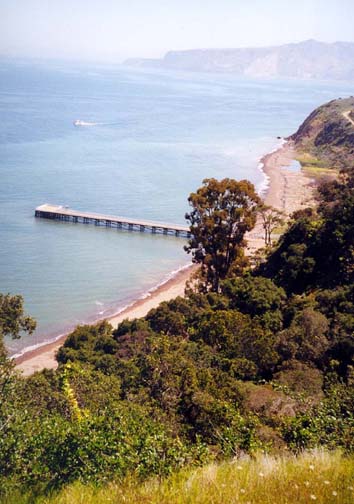
Islandpackers run a regular daily service from Ventura Harbor and Channel Islands Harbor to Santa Cruz Island. The boat leaves the mainland at either 8.00am or 9.00am and stops first about 1.5hr later at Scorpion Bay on the east end of Santa Cruz. After disembarking most of its passengers it then proceeds along the north coast to Prisoner's Harbor. The first part of the trip to Prisoner's Harbor is quite spectacular as the boat rounds the steep cliffs of Cavern Point. Look for the sea caves after which this headland is named; they attract many kayakers. Look also for the spectacular Potato Harbor, a cove ringed with cliffs of tortured rock.
|
|---|
| Scorpion Bay |
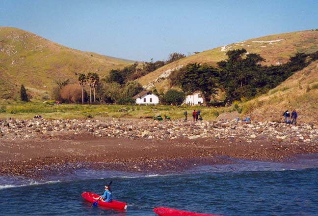
To the west of the cliffs is a a broad bay with a lower island profile. Prisoner's Harbor lies at the far end of this bay, its jetty (34o1.25'N 119o41.06'W) projecting out from the small floodplain created by the stream that descends from one of the largest canyons along the north coast, Canada del Puerto. One dirt road leads from the jetty area up Canada del Puerto to the old ranch house in the Central Valley, 3mi away and on Nature Conservancy land. Another dirt road climbs to the ridgetop on the National Park side of the border.
At the beach picnic area next to Prisoner's Harbor jetty, the Islandpackers staff usually conduct an orientation that includes information on the various hiking possibilities. They will then lead the guided hike to Pelican Bay.
Hike
From the boat jetty, you hike inland along the dirt road that heads into Canada del Puerto, the canyon behind Prisoner's Harbor. You pass an extensive set of corrals and an old garage-like building (dated 1897). Just behind the garage is a convenient restroom. Shortly thereafter the road forks: straight ahead is the road that climbs to the ridgetop and to the Del Norte campground on Park Service land. For Pelican Bay, you turn right and, about 100yds further, just before the gate to the Nature Conservancy property, you will find the start of the trail to Pelican Bay on the right side of the road (34o1.05'N 119o41.02'W). The trail first climbs to the top of a low bluff where there is a small folly containing descriptions of the island.
The trail continues to climb gently as it contours northwest toward Pelican Bay, negotiating five substantial canyons along the way. The first canyon is relatively small. The second is a large canyon with a high dryfall visible upstream from an overlook (number 11 of the guided tour stops). Several more canyons follow before you come to stop number 18 where you get a lovely view northwest toward Pelican Bay. From there the trail descends and crosses some grassland before following a ridge down toward the sea. Near the ocean it drops into a steep-sided gully that meets the sea at Tinker's Cove. Take a moment to enjoy the pebbly beach at Tinker's Cove.
 | 
| |
|---|---|---|
| Prisoner's Harbor | Pelican Bay |
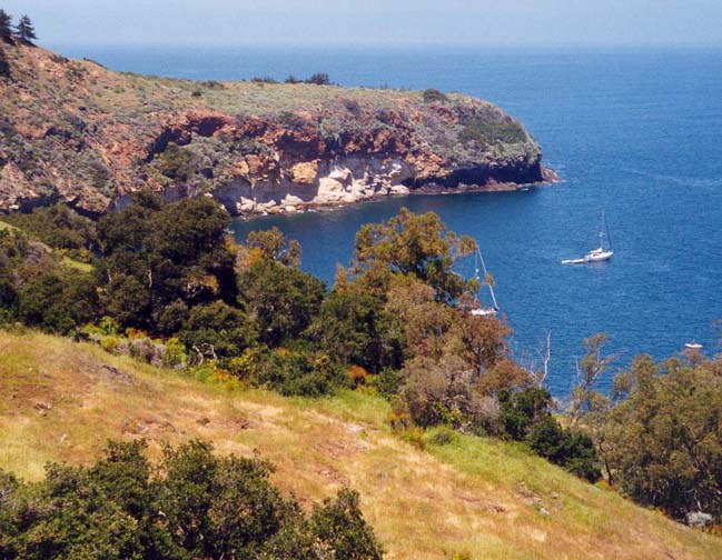
To view Pelican Bay, just over the next bluff, proceed up the canyon wash for about 100yds to where you will see the remains of an old wall above you on the right. A steep trail leads up to these foundations of a building where there is a beautiful overlook of Pelican Bay (34o1.96'N 119o42.18'W). The foundations are the remains of Eaton Resort, a hideaway that Humphrey Bogart and his friends frequented during Prohibition. An old trail leads down to the water's edge where there is some delightful swimming. You return to Prisoner's Harbor by the same route. Normally the boat comes to collect you about 3.00pm which leaves plenty of time for the hike.
Last updated 4/21/03.
Christopher E. Brennen