ADVENTURE HIKES AND CANYONEERING
IN THE SOUTHWEST
© Christopher Earls Brennen

|
|---|

|
Hike J1. Mount Lassen
- Hiking time: 4 hours
- Estimated hiking distance: 5.1 miles
- Elevation gain: 1968 feet
- Topo Map: Lassen National Park Topographical Map
- Difficulties: Sometimes very windy but no special difficulties
- Special equipment: None
Characteristics
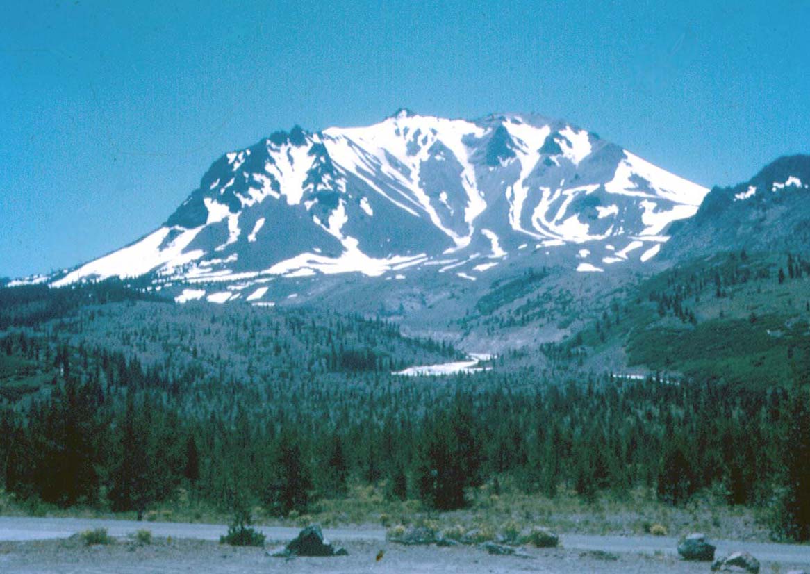
Mount Lassen is a 10457 ft active volcano, the principal feature of Lassen Volcanic National Park in northern California (40o29.30'N 121o30.23'W). Beginning in 1914, Lassen Peak began a period of eruptive activity. On May 22, 1915 the mountain experienced massive eruption, the ash plume rose over 30,000 ft and spread ash over 200 mi to the east. The area immediately to the east of the volcano was destroyed, striped of its trees and soils and massive rocks were strewn throughout the area. Many of these rocks were too hot to touch for days after the eruption. While the 1915 eruption was the peak of the activity, smaller eruptions continued for six more years, finally ceasing in 1921.
The mountain is one of the easiest active volcanos accessible to the average hiker. The bare rock-strewn slopes allow spectacular and uninterrupted views as one switchbacks back and forth up to the summit on the rocky and often windy trail to the summit.
Trailhead
The trailhead (40o28.49'N 121o30.27'W and elevation 8500 ft) is a clearly marked parking area just off Highway 89 just a few yards south of Lake Helen. Highway 89 is the principal paved road that traverses the park from north to south.
Hike
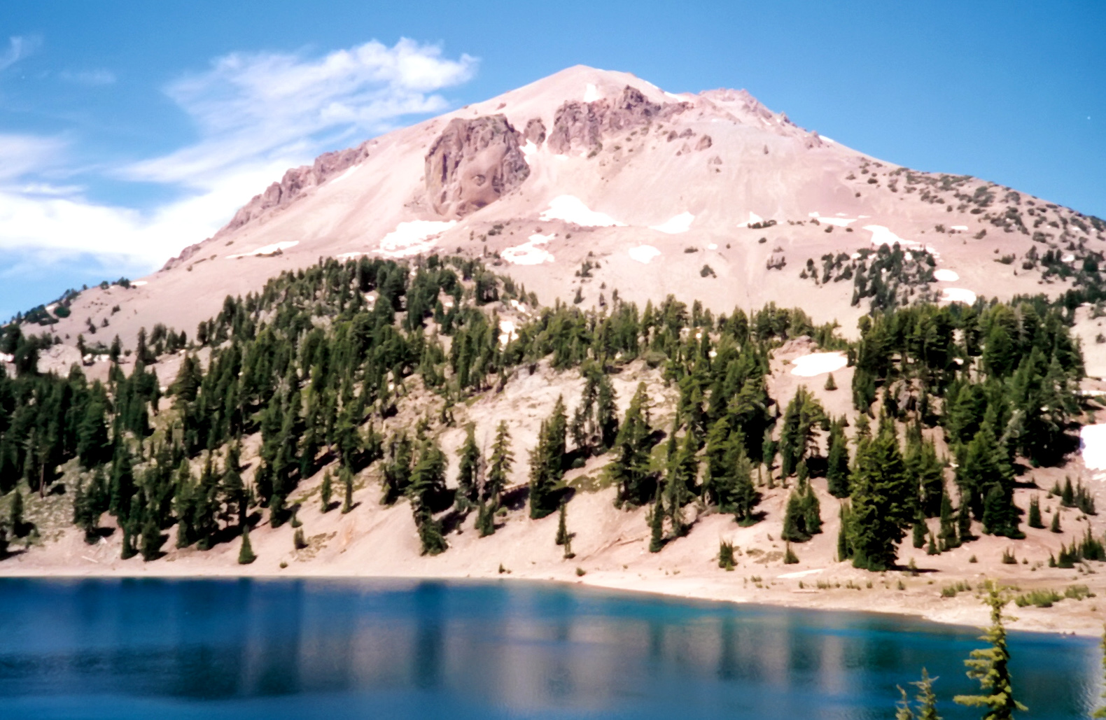
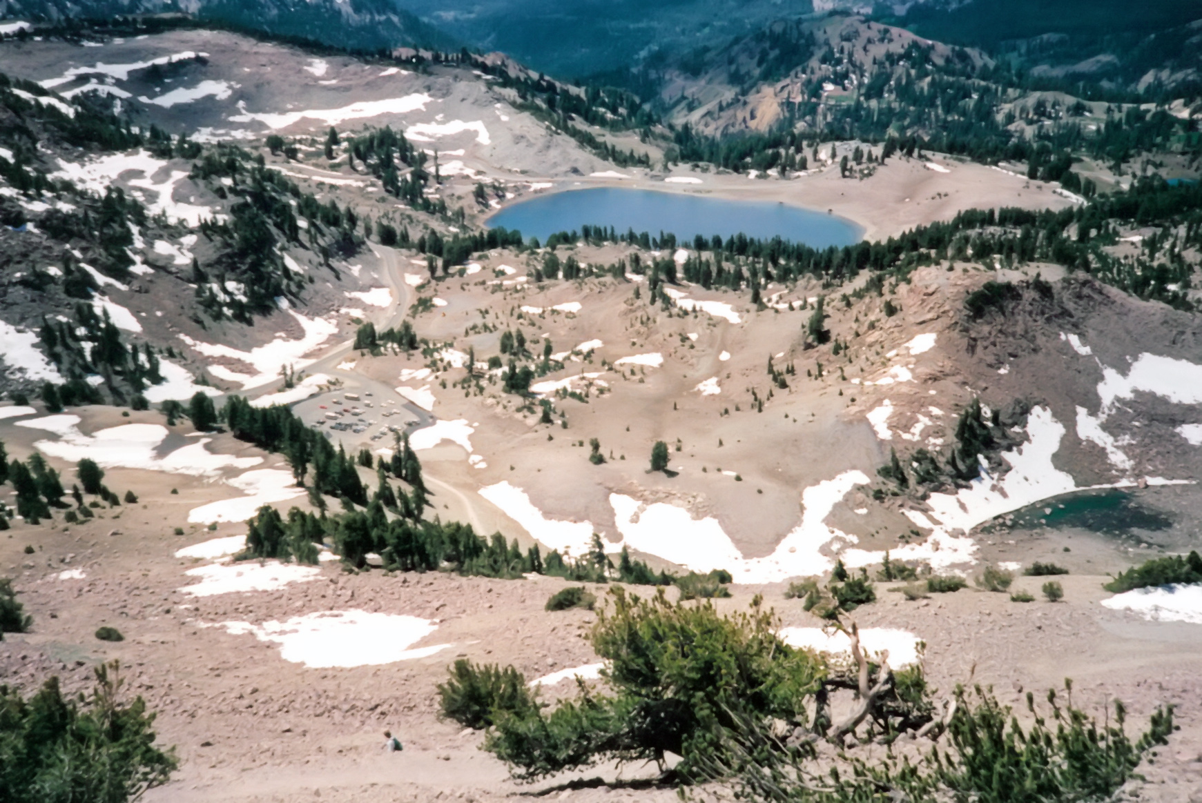
From the parking area (40o28.49'N 121o30.27'W and elevation 8500 ft) the trail climbs through twisted mountain hemlock and whitebark pine trees on a rocky trail. The trail starts easily, but as you asend the Southeast Ridge and gain elevation, the slopes steepen, the vegetation disappears and the exposure becomes intimidating as the trail switchbacks back and forth on the side of the volcano. Then, quite suddenly about 2.2mi from the trailhead and 1200ft higher, the trail gradient eases and you surmount a rise to find yourself on the cragged, 10457ft summit of Mount Lassen.
 | 
| |
|---|---|---|
| Mount Lassen | Lassen from trailhead |
 | 
| |
|---|---|---|
| View from summit trail | At the summit crater |
The views from the summit are spectacular in all directions: in the distance to the north you can see the snowny cone that is Mount Shasta, the next volcano to the north. Scattered around in the nearview are the crater and cragged remains of the Mount Tehama, the prehistoric volcano whose explosion created massive and widespread destruction that can still be seen especially on the northeast side of the mountain. The crater near the summit is somewhat hidden by snow but its cragged egdes are visible and accessible.
Last updated 30/11/2022.
Christopher E. Brennen