ADVENTURE HIKES AND CANYONEERING
IN THE SOUTHWEST
© Christopher Earls Brennen

|
|---|

|
Hike D13. Zion's Birch Hollow
- Hiking time: 6 hours
- Estimated hiking distance: 3 miles or 5.5 miles
- Elevation gain: 220ft or 820ft
- USGS Topo Maps: Temple of Sinawava, Clear Creek Mountain
- Difficulties: 11 rappels, one measuring 120ft
- Special equipment: Two 60m ropes (or one 60m and one 40m rope), harnesses and rappeling gear
- Permit: No permit required for exit up Orderville
-
ACA Rating: 3A III

Characteristics
The highlight of this adventure is a descent of Birch Hollow, a tributary of Orderville Canyon that lies outside the eastern boundary of Zion National Park. The hike continues up Orderville Canyon to a return vehicle placed before the hike.
In just a few hundred yards before its junction with Orderville Canyon, Birch Hollow contains a spectacular series of vertical descents through a narrow, fluted and sculpted slot that is still negotiable by an inexperienced canyoneer. The highlight is the last couple of rappels with the iconic wedged boulder high overhead. Prior to this last segment is a descent of a lovely wooded canyon interrupted by two large drops of 120ft and 50ft. We described here the return up Orderville Canyon to return Vehicles parked prior to the descent. However, some may choose to descend Orderville rather than ascend it; this involves a long, wet hike through Orderville and the Zion Narrows as well as a long car shuttle. It also requires a permit from Zion National Park since the descent takes you into the Park.
Trailhead
This hike requires a car shuttle. If you have two 4WD vehicles you can set up a longer shuttle that significantly shortens the hike out. Without such vehicles a car shuttle is still needed; the car shuttle is shorter but the hike out is substantially longer.
Travelling east out of Zion National Park on Route 9 toward Mt. Carmel Junction you pass through the East Entrance to the Park and about 2.5m east of the entrance station turn north on a paved road signed North Fork. Drive across the plateau for 8.2mi passing the turn-off to the left to the Zion Ponderosa Ranch shortly after which the pavement turns from asphalt to dirt. About 8.2mi from Route 9 look for a dirt turnout on the left at 37o18.587'N 112o51.324'W (elevation 6760ft) just before the road crosses Birch Hollow. This is where the hike starts but first you should set up the car shuttle by proceeding north another 3mi along the North Fork Road to a signed turn off on the left to "Orderville Canyon" at 37o20.222'N 112o49.777'W and an elevation of 6440ft. Proceed down this dirt road turnoff for about 0.25mi to a corral at 37o20.096'N 112o50.048'W and an elevation of 6380ft. Here you should leave the return vehicle if it is 2WD. If you choose the 4WD option then proceed through the gate (closing it afterwards) and drive down the steep, rough and highly rutted dirt road that descends into Orderville Canyon. At the bottom you must negotiate several deep gullies before the road flattens out and you can drive along a smooth dirt road to the trailhead, about 2.5mi from the corral at 37o20.030'N 112o51.527'W and an elevation of 5780ft. Leaving the return vehicles in place return to the North Fork Road and thus to the Birch Hollow turnout at 37o18.587'N 112o51.324'W and an elevation of 6760ft.
Hike
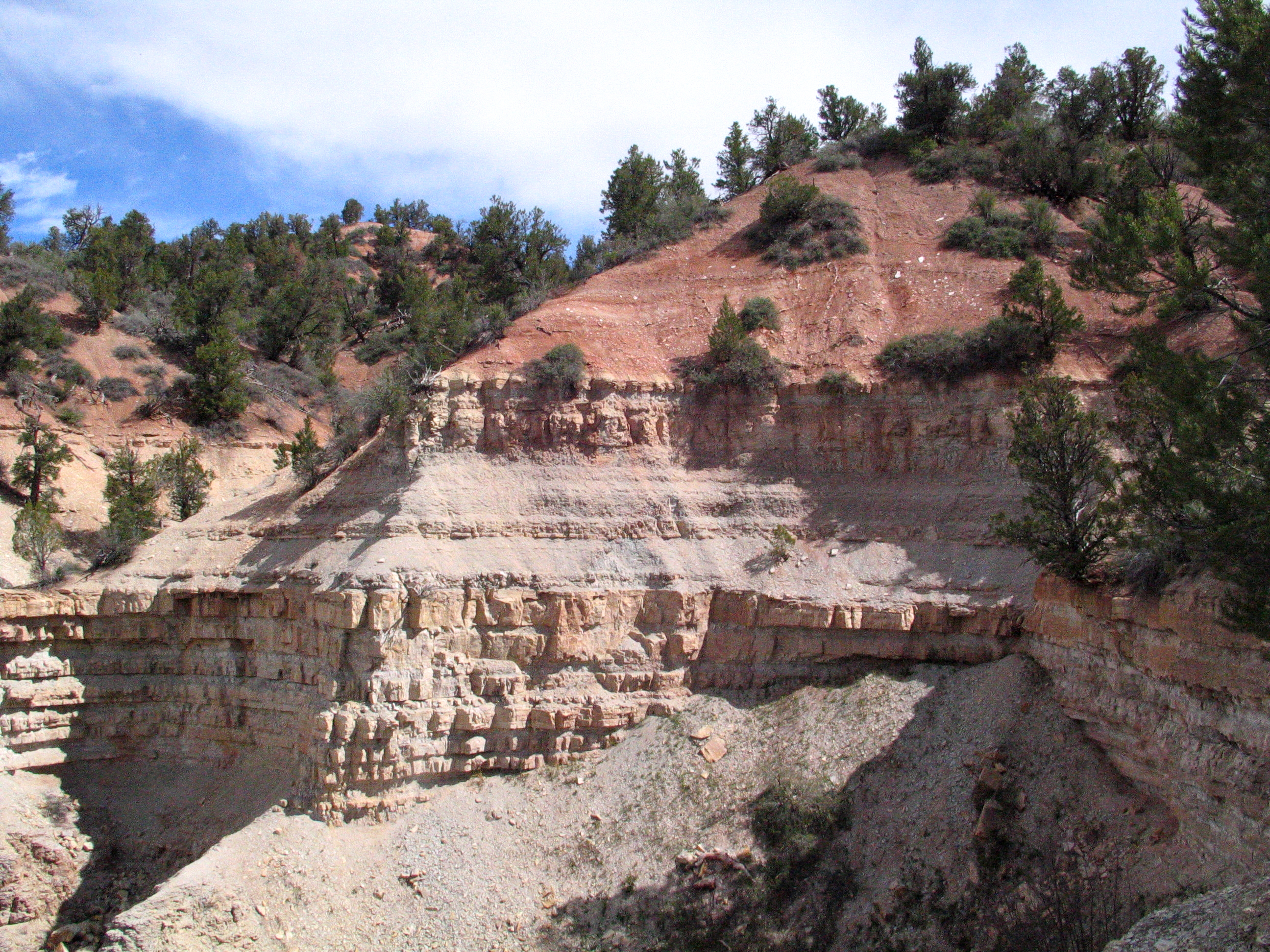
From the trailhead turnout at 37o18.587'N 112o51.324'W and an elevation of 6760ft adjacent to where the road crosses Birch Hollow, simply drop into the shallow canyon and begin the descent of Birch Hollow. Initially the use-trail down the gully is potentially brushy but it is now well worn and soon begins to level out into an easy hiking route. After about 20min you pass through a section with speckled-white walls containing gypsum. Another 20min begins you to the top of the first rappel at 37o18.966'N 112o52.324'W, and elevation of 6160ft and 1.4mi from the start. This first descent is a 120ft drop off a broad shelf. It can be bypassed by proceeding around the shelf to the left to a steep and loose trail that drops to the canyon bottom.
 | 
| |
|---|---|---|
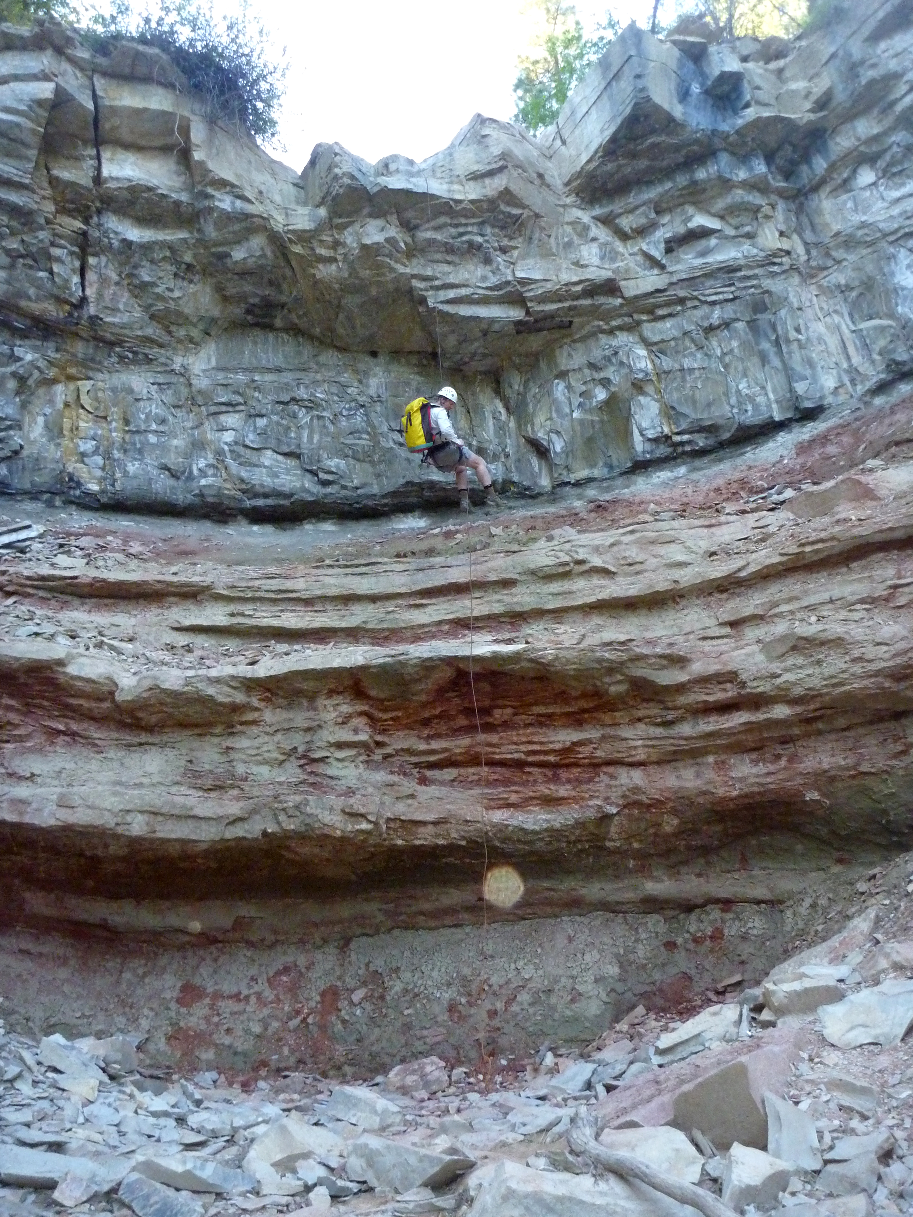
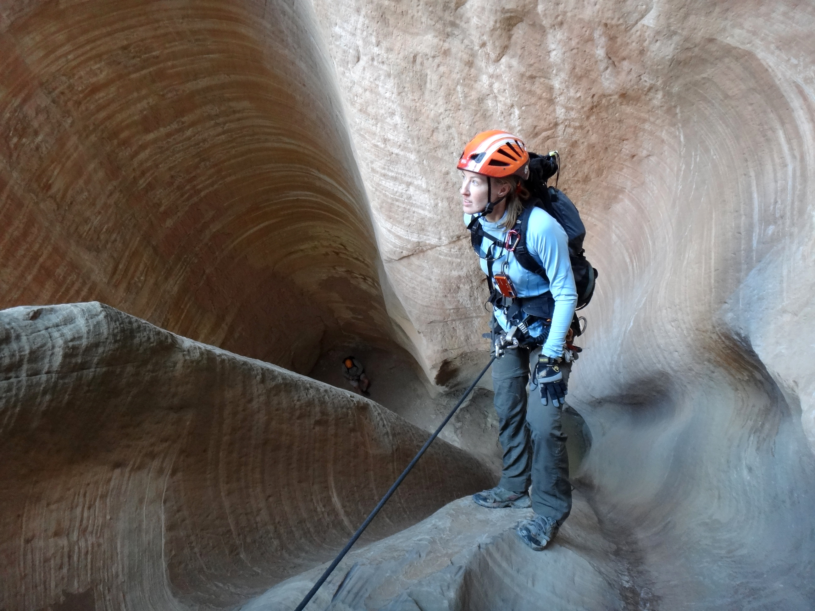
| View from top of the first rappel in Birch Hollow | Second rappel in Birch Hollow |
From the bottom of this rappel, you resume hiking down a pretty, wooded and broad canyon. About 1hr 10min from the start you will arrive at the top of the second rappel, a 50ft drop from log anchor just upstream of the lip. This rappel has a large undercut just below the lip that makes for a tricky rappel entry and a further undercut near the bottom. Below this second rappel is the first set of narrows in Birch Hollow. Here the first obstacle is a small, 10ft downclimb or rappel from bolt anchors in the right wall (we call this the third rappel) and this is followed by the fourth rappel, a 10ft drop from bolts on the right, and immediately by the fifth rappel, a 15ft descent from bolts on the left wall. After this the canyon opens up again and you hike through a pretty wooded section that leads to the start of spectacular last section of Birch Hollow. You should reach this point about 2.5hrs from the start.
 | 
| |
|---|---|---|
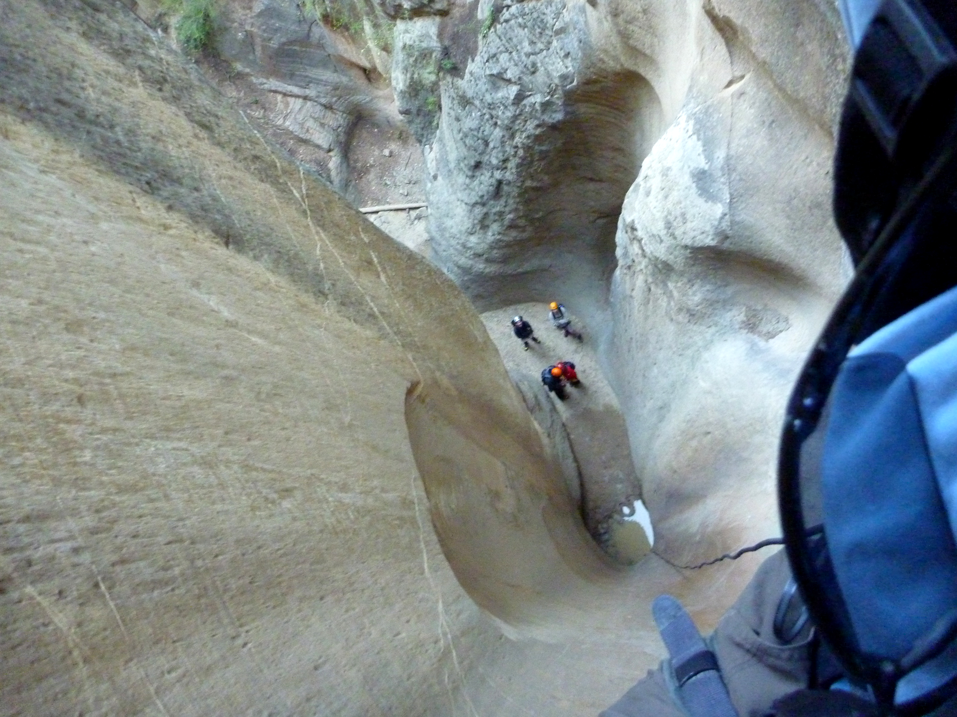
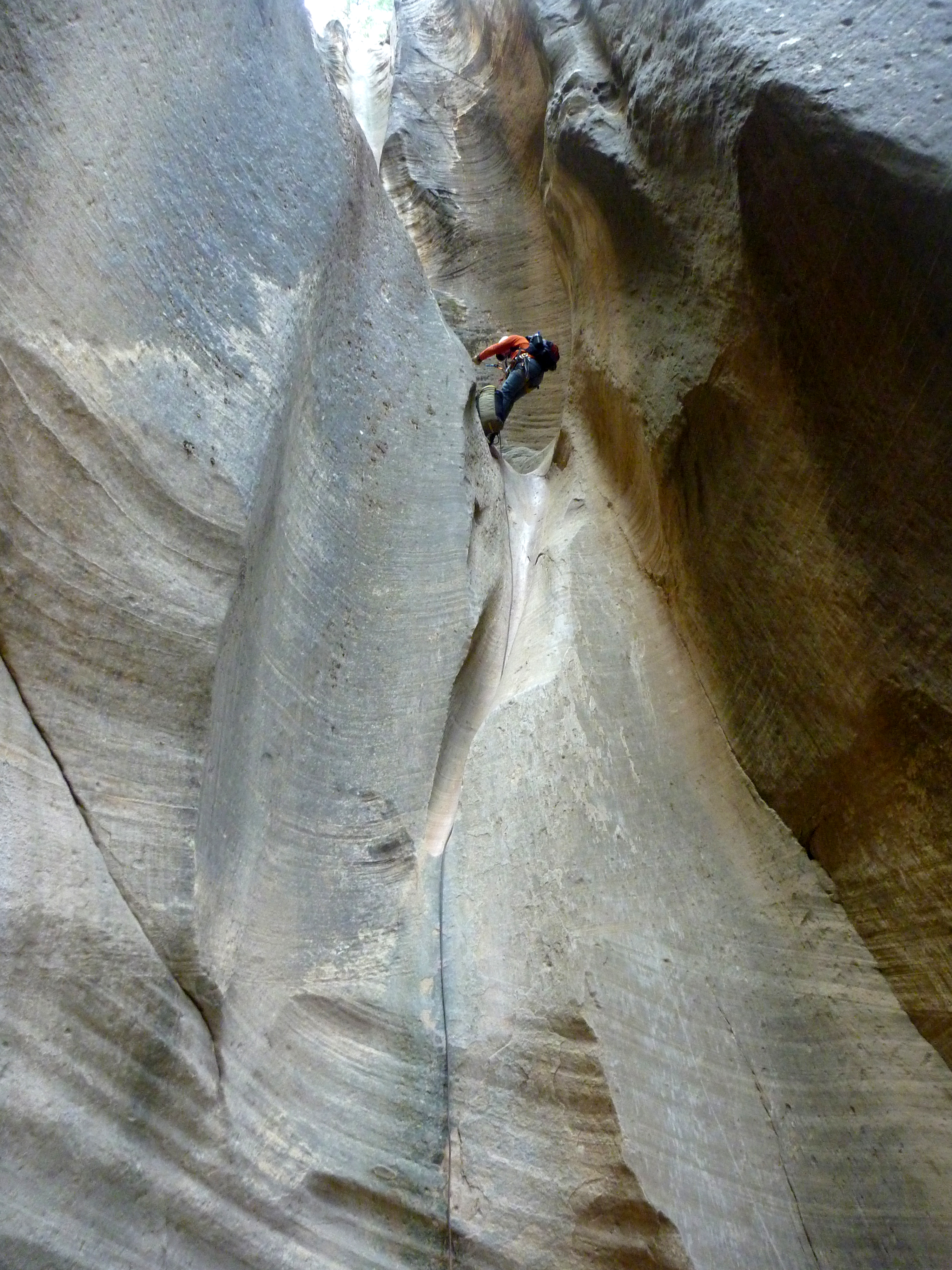
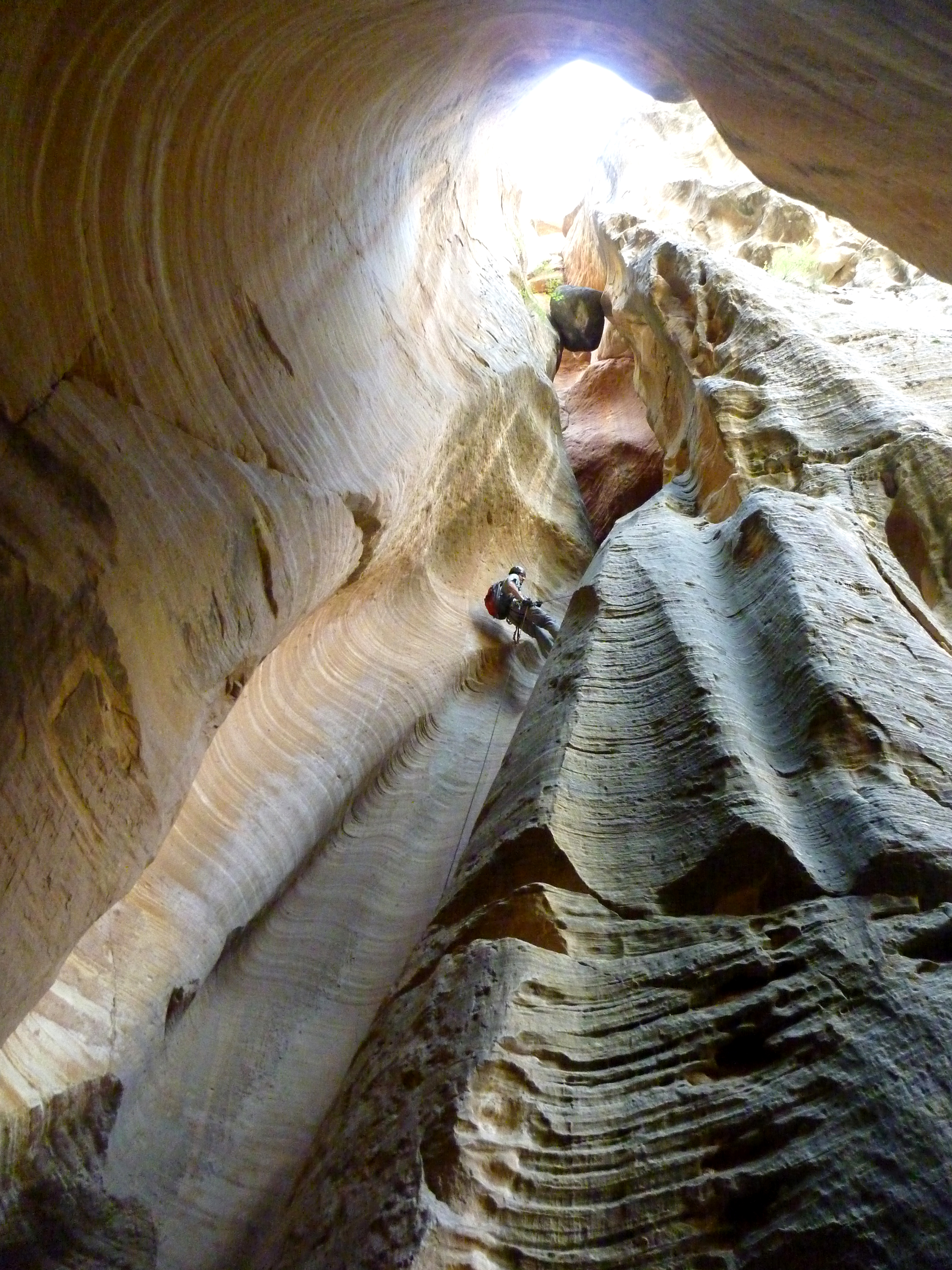
| 100ft sixth rappel in Birch Hollow | Dan Creveling on 40ft seventh rappel | |
(Photos by Johanna Turner) | ||
This last section begins with a beautiful, vertical 100ft rappel into a narrow slot from a convenient tree anchor on the left. This is immediately followed by the seventh rappel a 40ft drop down the continuing fluted slot using bolts on the right and by the eighth rappel, another 40ft drop from bolts on the right.
A short, narrow section of canyon leads to a 6ft downclimb and then to the ninth rappel, a 40ft drop from bolts on the right. You should reach this point about 3hrs 20min from the start. The tenth rappel follows immediately and consists of a spectacular 80ft vertical drop from bolts on the left. Look up when you can see around the corner to the right to see the iconic chockstone wedged high overhead between the canyon walls. This is a marvellous section of fluted sandstone. You drop down to a small sandy platform where the next and last rappel is just yards away. This eleventh rappel is a 60ft vertical drop from bolts on the left with the chockstone now directly overhead. Take time to relish this beautiful grotto with the chockstone a full stop in this awesome place. The junction with Orderville Canyon is just a few yards down the canyon from the last rappel.
 | 
| |
|---|---|---|
| Johanna Turner on last rappel | Last rappel in Birch Hollow | |
(Photos by Kirk Belles and Johanna Turner) | ||
The junction with Orderville Canyon is at 37o19.408'N 112o52.522'W, and elevation of 5560ft and 1.8mi from start and you should reach this point about 4hrs from the start. Take a break here to remove your harness and prepare for the much warmer hike out up Orderville (a right turn!). The hiking is easy though, after about 30min you should look for the trail climbing the mud banks on the right at 37o19.510'N 112o52.190'W and an elevation of 5600ft. Follow this steep trail as it ascends to a rim to the right of some pretty fluted rock chimneys. From the top of this rim an easy, fairly level hiking trail leads back to the 4WD trailhead in the now-flat bottom of Orderville Canyon. You should reach this point at 37o20.030'N 112o51.527'W, an elevation of 5780ft and 1.2mi from the junction of Birch Hollow and Orderville Canyon about 5hrs from the morning start having travelled a total distance of about 3mi.
If you chose the 2WD option you should continue to hike along the dirt road as it first proceeds up Orderville on a relatively flat, smooth road and then ascends the side of Orderville on a rough and rutted 4WD road eventually arriving at the gated corral at 37o20.096'N 112o50.048'W and an elevation of 6380ft where your 2WD return vehicle was parked. It takes about 45min to complete this extra hiking leg and about 20min to drive it. The total distance from the start to the corral is about 5.5mi.
The last task is to drive back the short distance from the corral to the North Fork Road at
37o20.222'N 112o49.777'W (elevation 6440ft), turn right and
drive back to the starting point.
Christopher E. Brennen