THE FAR SIDE OF THE SKY
© Christopher Earls Brennen
MOYOLA RIVER
``I will break through," he said, ``what I glazed over
With perfect mist and peaceful absences" Ś
Sudden and sure as the man who dared the ice
And raced his bike across the Moyola River.
A man we never saw.
From ``Glanmore Sonnets" by Seamus Heaney.
In the early 1950s my father decided to construct a two-man canoe in which to paddle the waters of some bucolic Irish river. I think the inspiration for this was derived from a canoeing holiday that one of my uncles had enjoyed on a river in southern Ireland. Indeed my father seemed to have inherited the remains of my uncles collapsible canoe that consisted of a foldable canvas shell within which a frame of wooden rods was to be assembled. However, we never managed to complete this assembly and so my father decided to construct his own canoe that would not be collapsible. It would still be canvas on a wooden frame but a rigid rather than removable frame.
This new canoe was constructed in one of the attic rooms in our house. It was carefully fabricated and a few test paddles were nervously but successfully conducted in a nearby pond. After that my father's interest waned and he moved on to other activities. However, a year or two later, I had just begun my lifelong adventuring with a hike over the top of Slieve Gallion (see "Flowers on the way to Slieve Gallion"). Casting around for more adventure, my friend Frank Johnston and I decided to see how far we could float down the nearby Moyola in the "new" canoe.
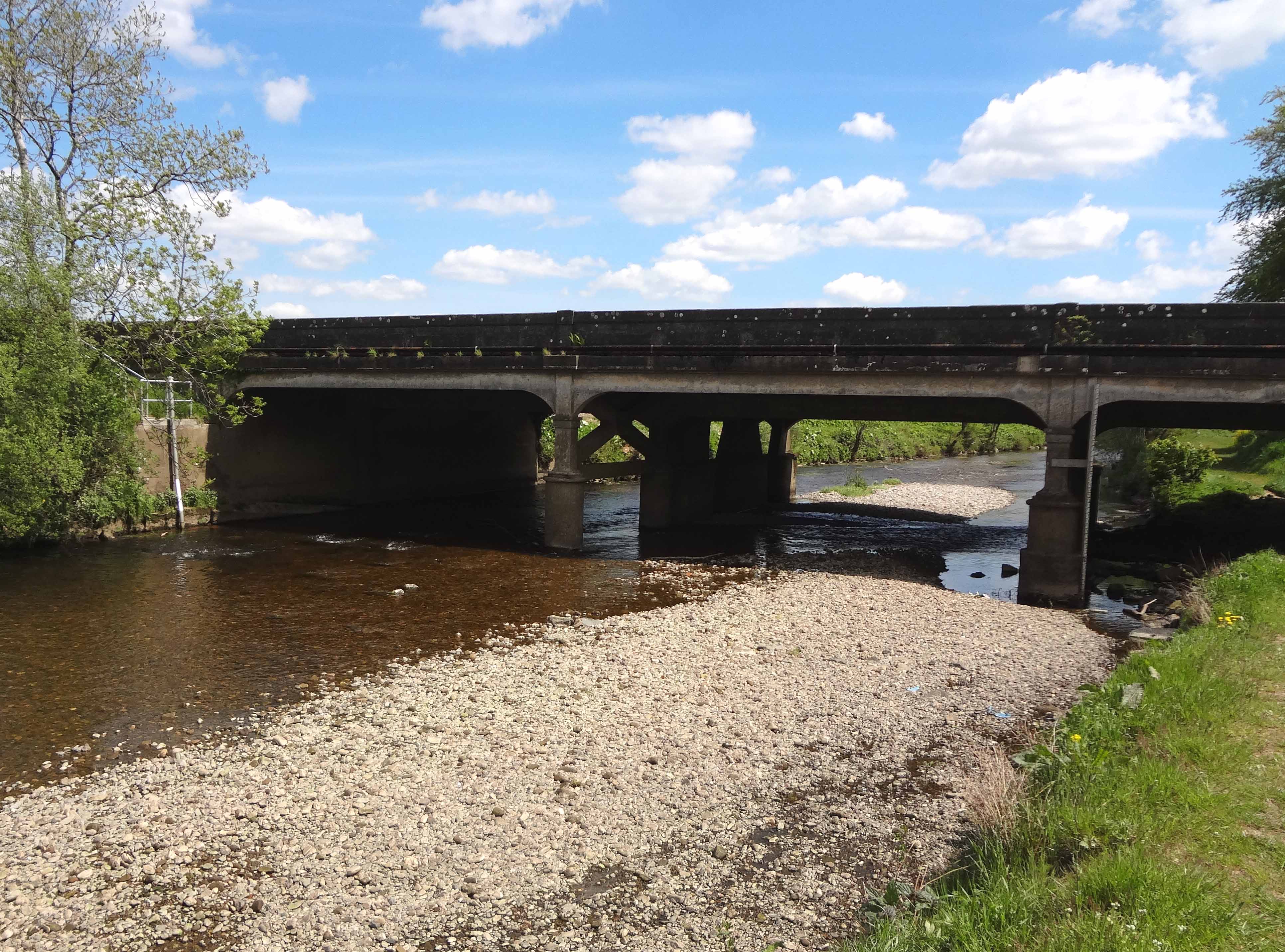
The Moyola was the only river of any size close to Magherafelt. Rising near Mullaghturk peak in the Sperrin Mountains, the Moyola winds its way through the rolling farmland of southeast County Derry for 27 miles before emptying into Lough Neagh. A little preliminary scouting revealed that the river upstream of the road bridge on the Tobermore/Maghera road (at 54deg. 47.150' N, 6deg. 41.903' W) was too shallow for reasonable canoeing and so we decided to put in at that point. We knew of several other road bridges further downstream and had reconnoitered the river from those vantage points; but we had little information on the river in between those viewpoints. Nevertheless, with the confidence of youth, we decided that we knew enough. Therefore, in the early summer of 1959, we began preparations for this canoeing adventure into the unknown. What attracted me to this exploit, indeed to all the adventures in the fifty plus years that followed, was precisely the thrill of venturing into the unknown, of finding out what was round the next corner or over the next hill and of meeting the challenges that followed.
Having obtained my father's approval to use his canoe and his willingness to deposit us at our starting point, we began collecting the gear we would need. Food and water were obvious. But we also knew that the canvas surface of the canoe was not particularly rugged; it could easily be penetrated if we made contact with rocks in the shallower parts of the river. Fortunately, we knew of adhesive and waterproof bandage tape called "Elastoplast" that my father made valuable use of in his doctoring activities. We obtained a liberal supply of Elastoplast and set off one Saturday morning for the Tobermore/Maghera road bridge (at 54deg. 47.150' N, 6deg. 41.903' W).
 | 
| |
|---|---|---|
| Starting point: Tobermore/Maghera bridge. | Looking downstream from starting point. |
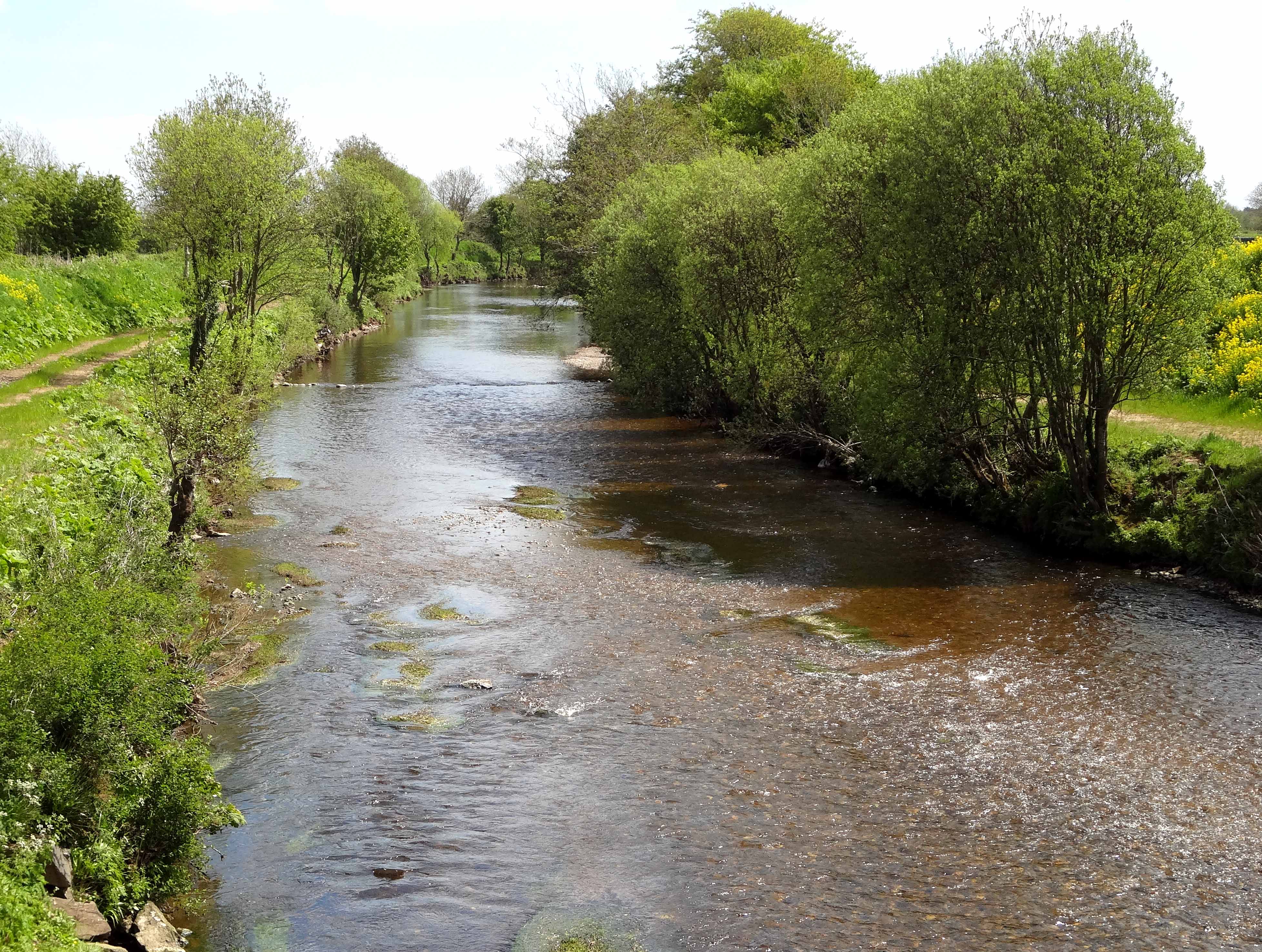
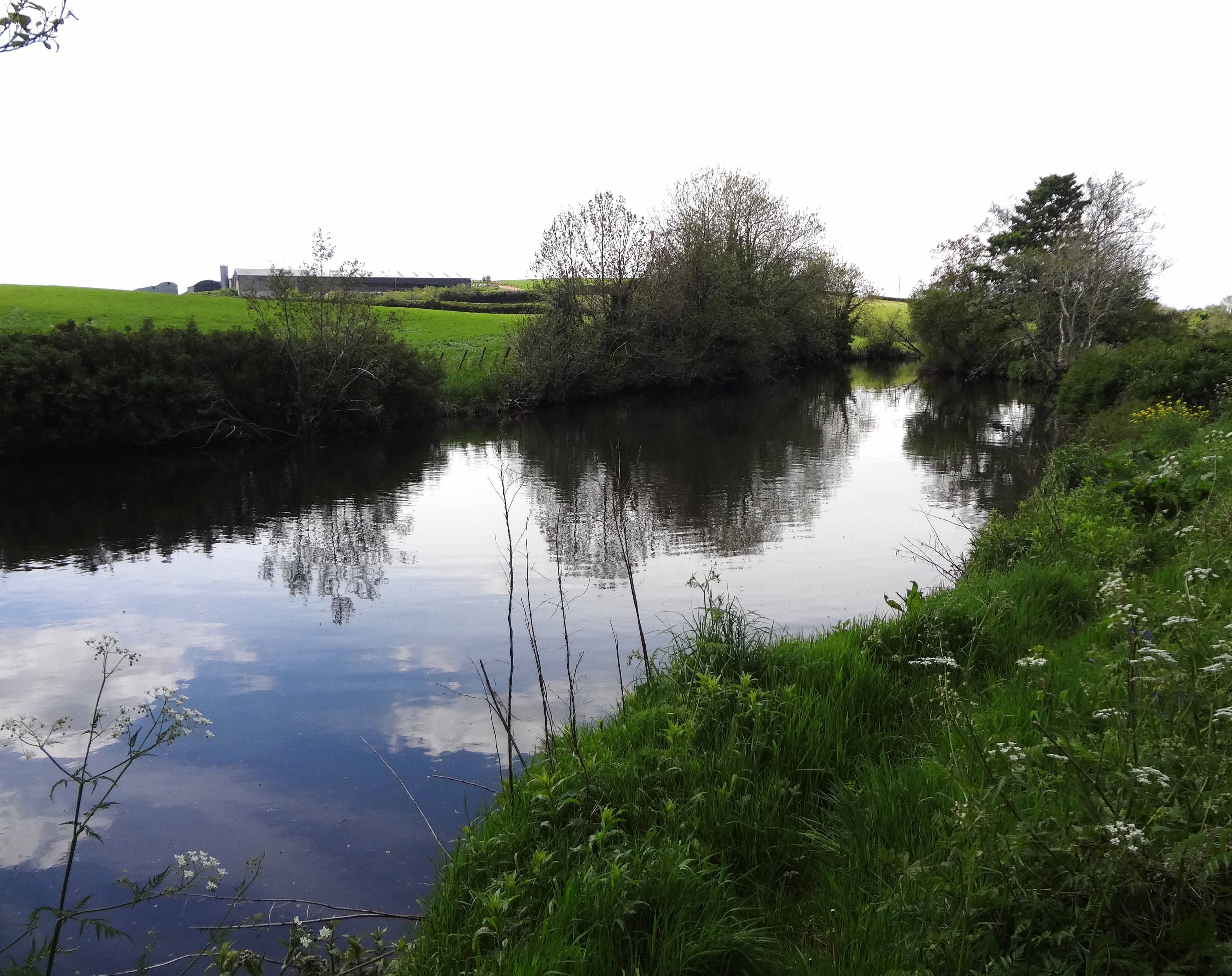
I do remember the mild but exciting apprehension with which we slid the loaded canoe into the water downstream of the Tobermore/Maghera road bridge in preparation for departure. It was a beautiful, sunny Irish day. To the west of us the heather-encrusted Sperrin Mountains glowed purple in the sunlight and all around the lush green fields seemed to welcome us. As long as rain and misfortune stayed away it promised to be a glorious day. We bade goodbye to my father (who must have wondered if he would ever see his canoe again) and started downstream, Frank in front and me behind. Not much paddling was needed but we soon encountered the first of many small rapids, some of which we needed to wade in order to negotiate. Inevitably the first rip in the canvas occurred, the Elastoplast came out and the canoe received its first badge of honor. On we drifted with kingfishers flashing past us and startled herons rising majestically before us. Though farm fields lay all around I don't think we saw a single person all day long. The river was its own sanctuary and we felt we should slip respectfully through this ribbon of near-wilderness. More riffles were encountered and negotiated but the bottom of the canoe began to look like a canvas war-zone; the Elastoplast supply was dwindling fast. We passed the junction with the Grange Water river at 54deg. 47.990' N, 6deg. 36.486' W and pressed on downstream.
 | 
| |
|---|---|---|
| Curran bridge. | Looking downstream from Curran bridge. |
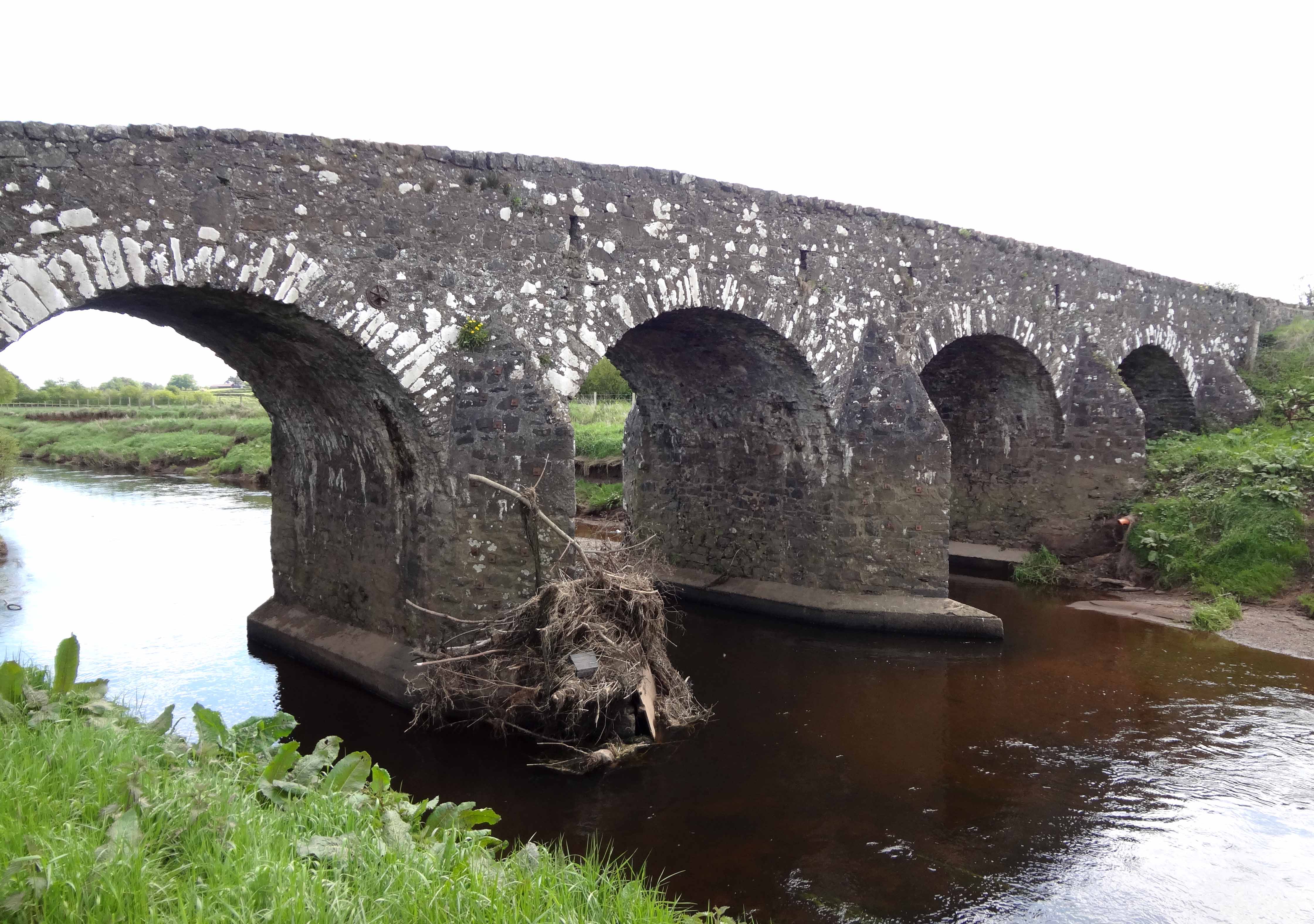
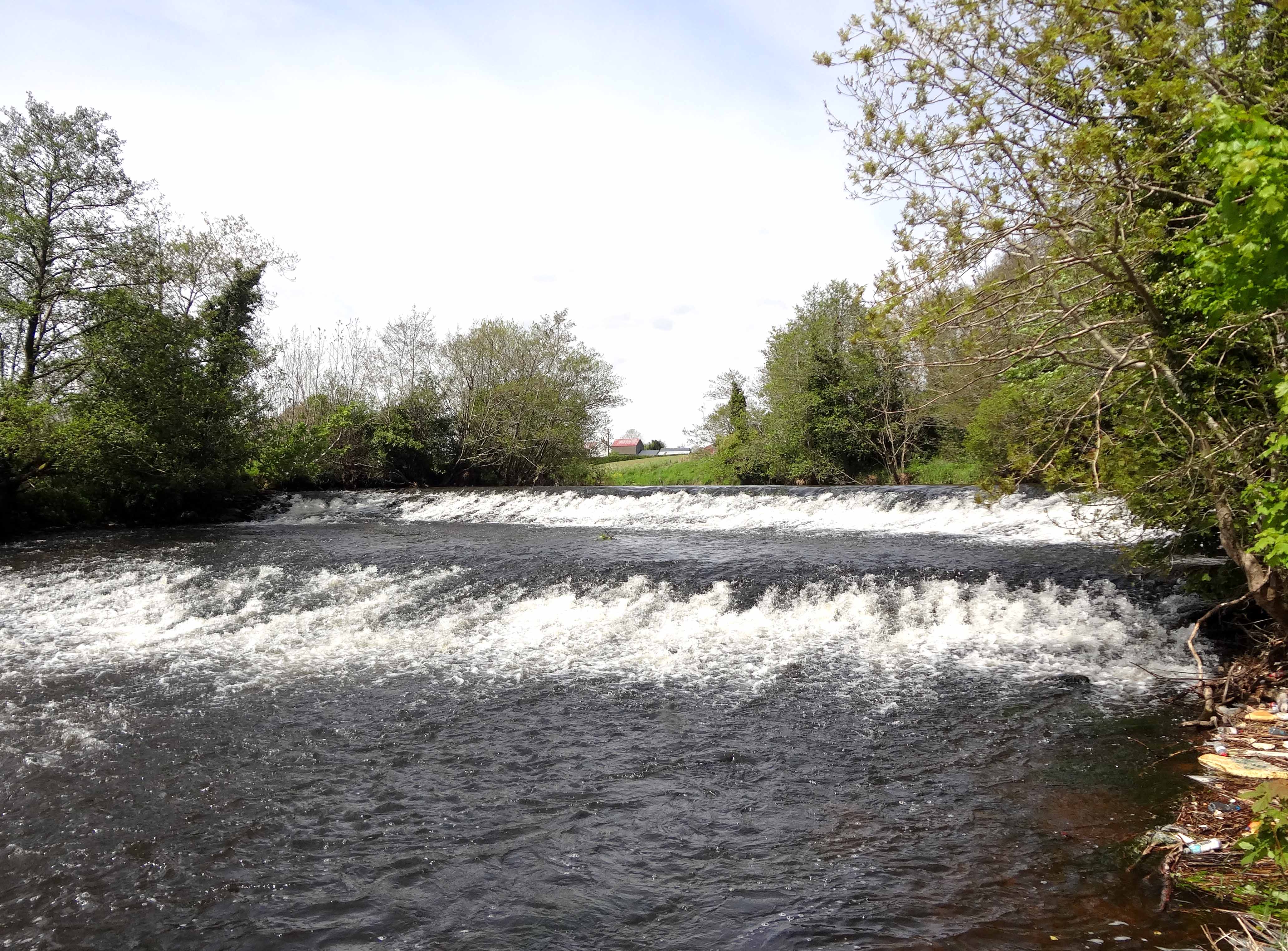
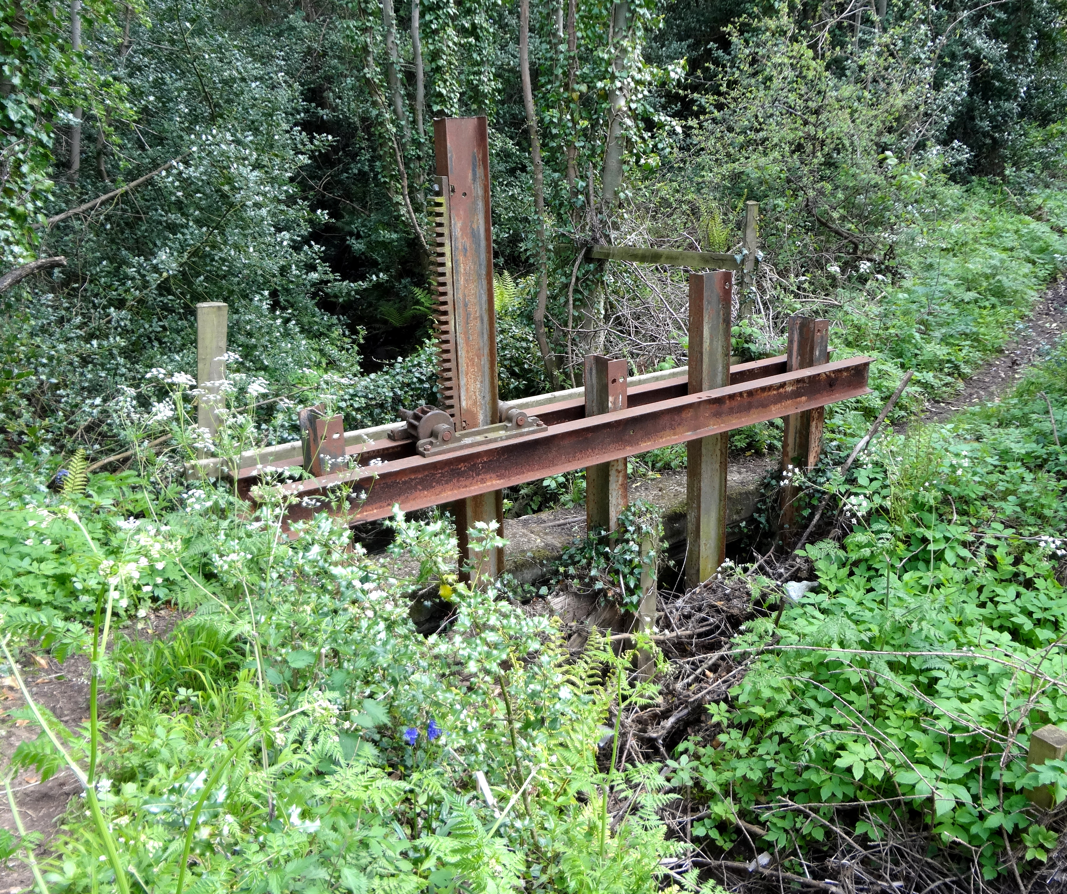
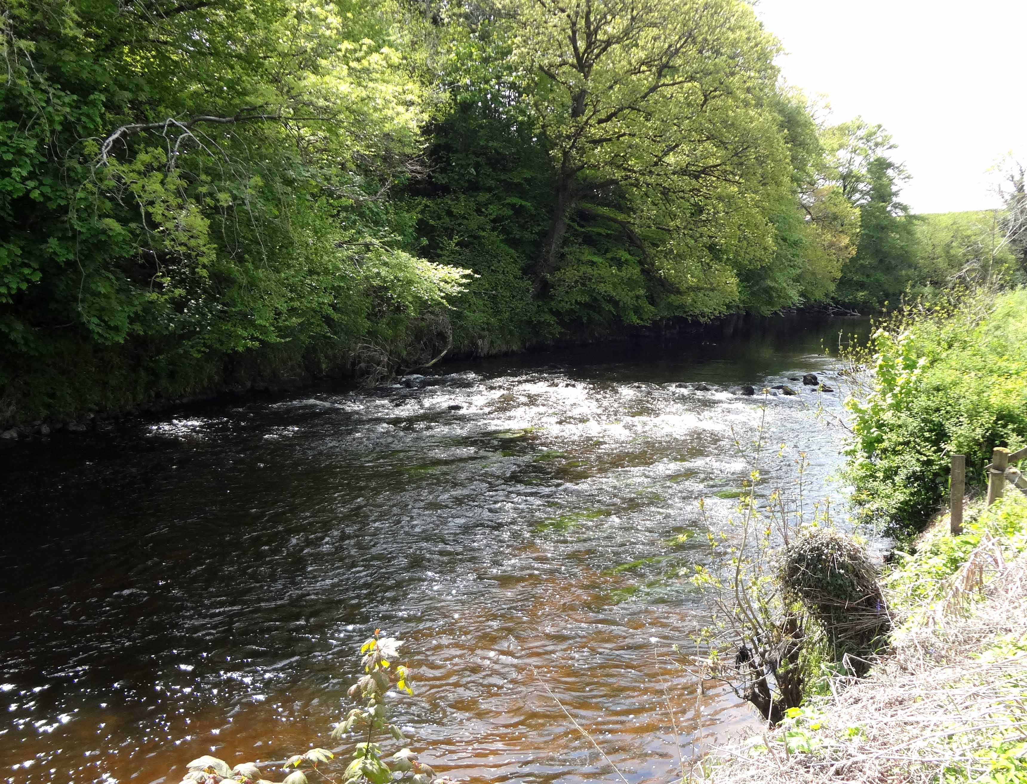
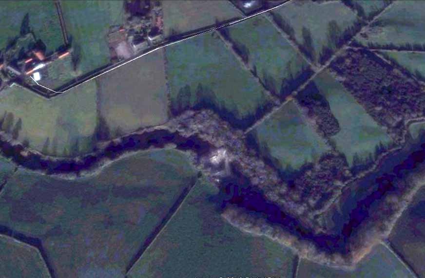
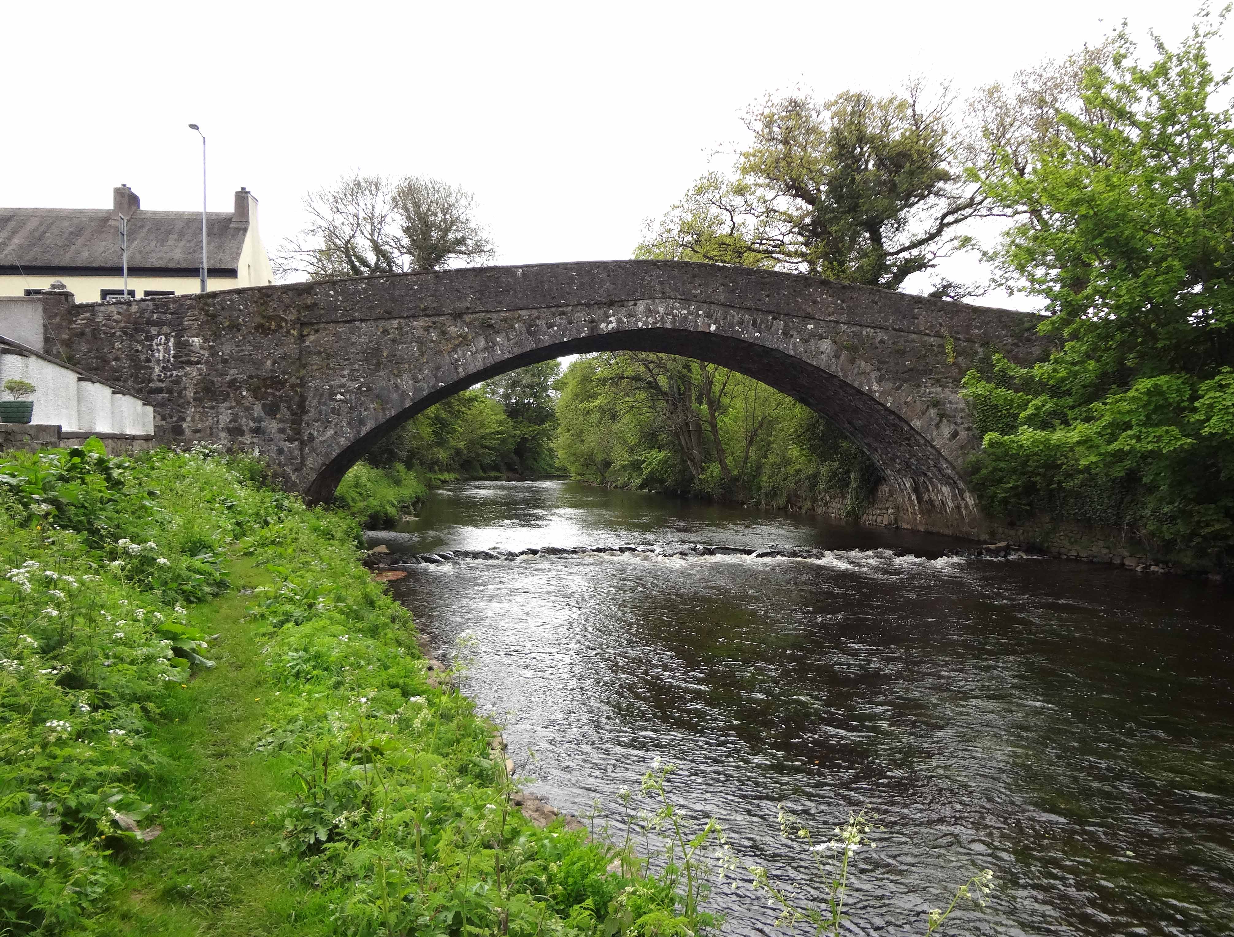
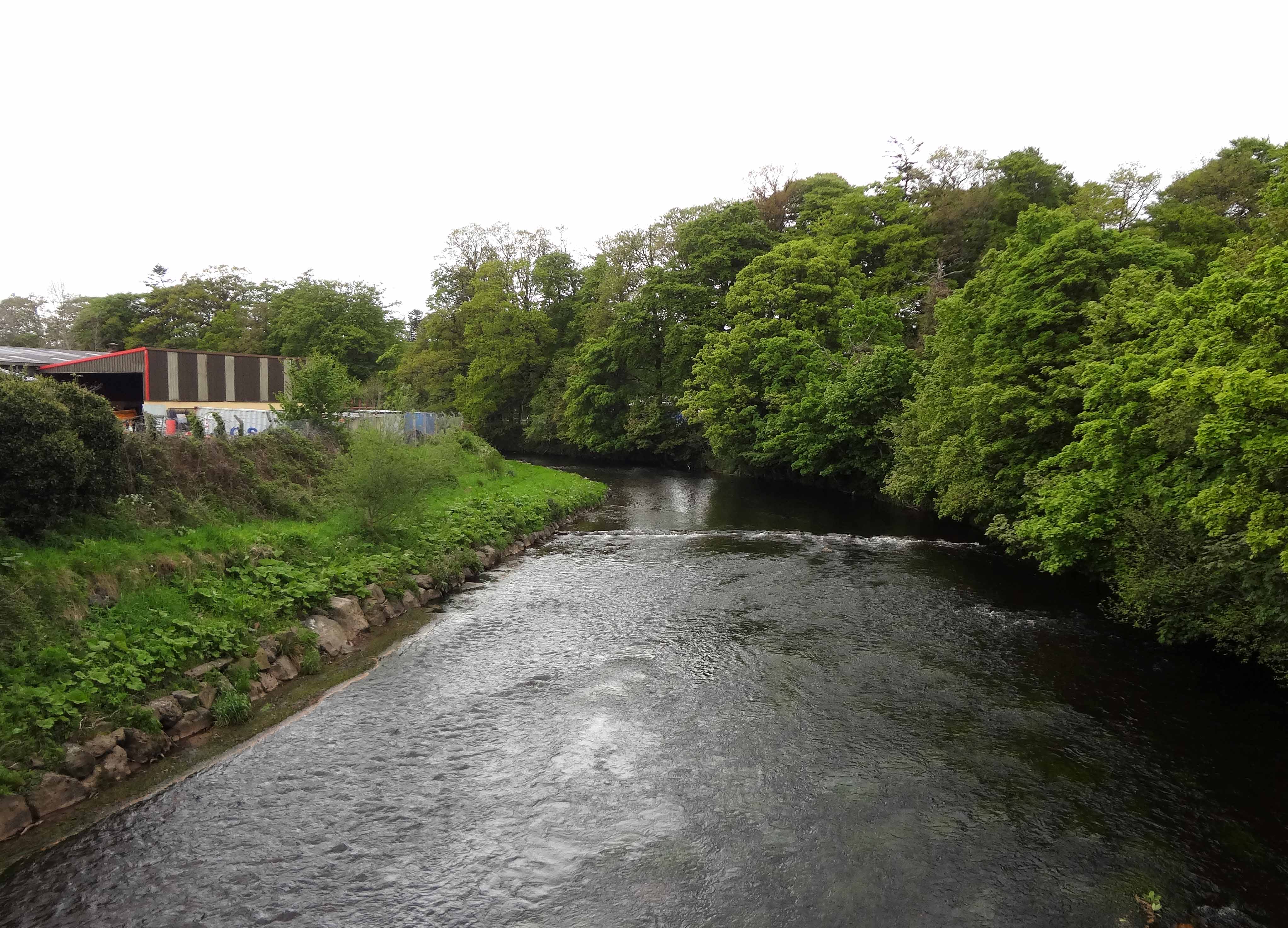
Several hours into our adventure and just beyond the Grange Water junction, we came to the lovely old Curran bridge, named after the nearby hamlet that recorded a population of 130 in the 2001 Census. A beautiful old stone, four-arch bridge carrying a single lane across the Moyola (at 54deg. 47.980' N, 6deg. 36.758' W), the Curran bridge must date back at least to the 1800s if not before. Instantly recognized, we floated through it relieved to know where we were. The river was now fuller and easier to traverse. However, a little over 1/4 mile downstream of the Curran bridge we came to an old weir or dam (at 54deg. 47.785' N, 6deg. 35.115' W) that dropped about 6ft in two stages. Throughout Ireland (and indeed Europe) dams like this were built in conjunction with a race, a diversion of part of the flow used to drive a water wheel and mill to process the local agricultural produce. They represented the first mechanization, the first industry, and were an essential and fundamental step in the development of civilization. The sluice gate that regulated the flow into the race of this first weir is still extant though overgrown and long forgotten. During our long-ago adventure this weir was our first significant obstacle and initially us caused some trepidation. But it was easily portaged and we were soon on our way.
 | 
| |
|---|---|---|
| Upstream of first weir. | First weir. |
 | 
| |
|---|---|---|
| Sluice gate entrance to race at the first weir. | Downstream of first weir. |
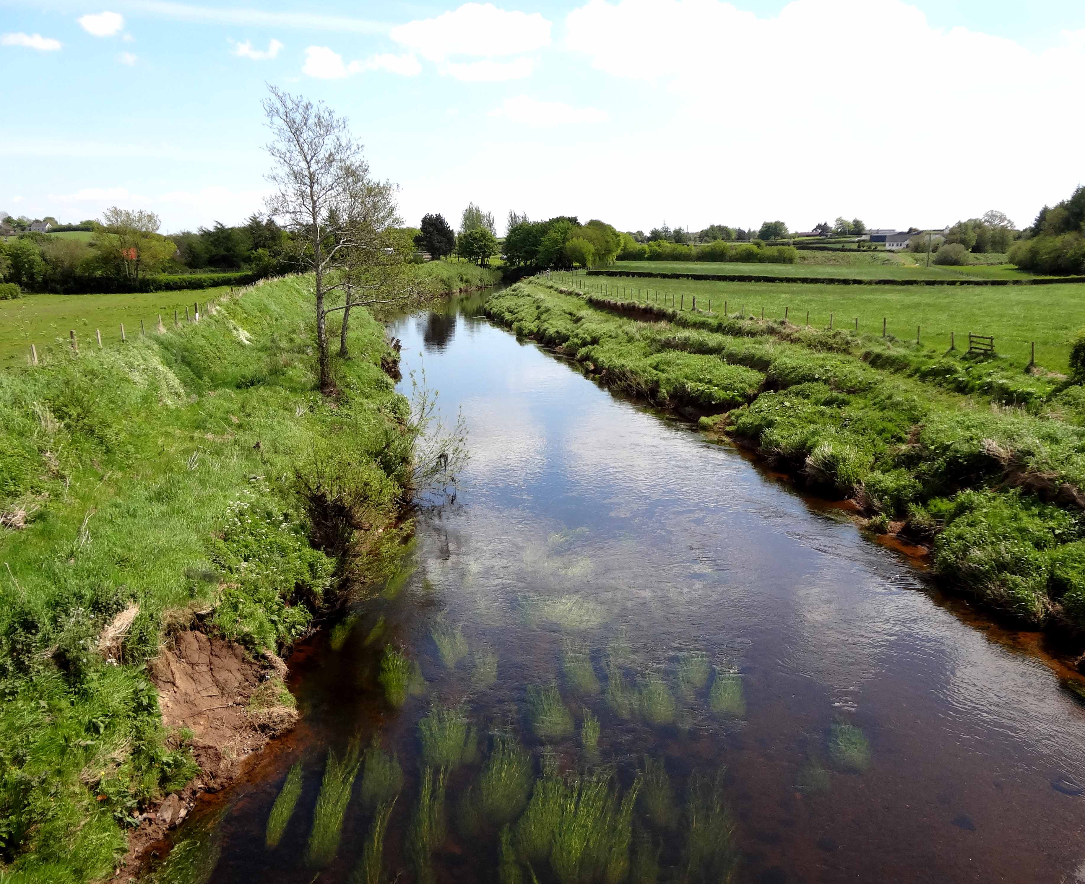
Not far downstream of that first weir we found ourselves surrounded by woods. Indeed, until the middle of the 1700s, this whole region of County Derry was a dense forest, celebrated for being the haunt of wolves. The last wild wolf is reputed to have been killed in the middle of the 18th century. Part of that forest was obtained by the settler Thomas Dawson in 1633 and became the private domain and estate of the Dawson family who called it Moyola Park. As with many of the private estates of the landed aristocracy in Ireland, a substantial stone wall was built around this domain in the 1800s. The purpose was twofold - to clearly define that estate and to provide some employment and relief during the terrible years of the famine. Most of these tall stone walls remain. While the relief they provided is long forgotten, their stark statement of segregation still resonates, still generates inevitable resentment.
 | 
| |
|---|---|---|
| Fields around the first weir (in white). | Region around Moyola House weir (in white). |
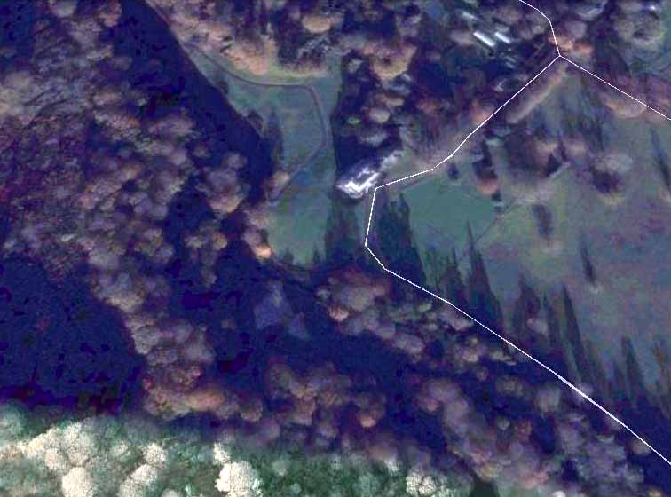
On that day in 1959, we did not know when we entered Moyola Park and the demense of the Dawsons for there was no stone wall across the river nor any other sign of the boundary (modern GPS tell us that boundary was at 54deg. 47.510' N, 6deg. 34.115' W) along our route. We did suspect that we had entered grounds where we were not welcome but it was still a surprise when we suddenly found ourselves floating past the manicured lawn at the foot of a great mansion. We ducked down to reduce the possibility of being seen as we floated by, trailing streamers of Elastoplast in our wake. My mother would have been mortified if she had known where we were!
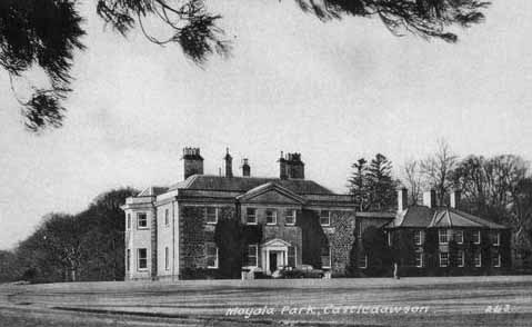
The great house in Moyola Park, the seat of the Dawson family, was built in 1713 by Joshua Dawson who was the Chief Secretary of Ireland in 1710. Both the house and the adjacent village became known as Castledawson. Joshua's descendant, George Robert Dawson (1790¢1856), son of Arthur Dawson, was born at Castledawson, and married Mary Peel, the daughter of the British Prime Minister, Sir Robert Peel. Their son, Robert Peel Dawson (1818-1877), was the father of Mary Dawson, who became the heir to the Moyola estate. Mary was the great-grandmother of the brothers James Chichester-Clark (1923-2002) and Robin Chichester-Clark (1928-) who grew up in Moyola Park. Robin was the MP for Londonderry in the British House of Commons from 1955 until 1974. After an army career, James retired to Moyola Park in 1959. He was a member of the Northern Ireland Parliament for South Londonderry for 12 years beginning at the by-election to replace his grandmother Dehra Parker in 1960. James went on to become the penultimate Prime Minister of Northern Ireland. He married the widowed Moyra Haughton (they had two daughters). In the aftermath of his political career James was created Lord Moyola in 1971 and died in 2002. Though the father of James and Robin Chichester-Clark died in 1933, their mother, Marion Caroline Dehra Chichester-Clark, lived at Moyola Park until she died in 1976.
 | 
| |
|---|---|---|
| Moyola House. | Moyola House weir. |
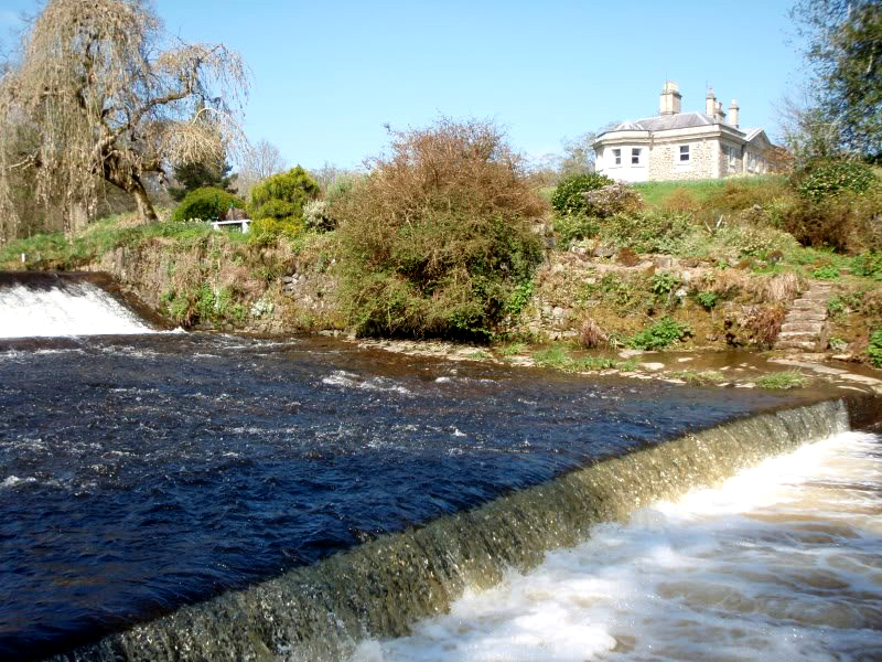
Therefore, as far as I can tell, at the time of our adventure in 1959, the Moyola Park mansion was occupied by the 55-year-old widow, Marion Chichester-Clark, though her son, James, would shortly be moving in with his family. Of course, neither Frank nor I had any clue as to who lived in the great house that neither of us had ever seen before. But the drift of the river and the need for silent passage left us little alternative but to slip past as quietly as possible. Just a few yards beyond the house, the Moyola encounters its second weir (at 54deg. 47.014' N, 6deg. 33.634' W), a larger drop than the first weir. We portaged around this on the right-hand side, the side furthest from the house that, I believe, was now out of sight. Continuing downstream through the woods, we negotiated several small rapids before signs that we had left the park were encountered. Soon we came upon an old, somewhat familiar single-arch bridge (54deg. 46.749' N, 6deg. 33.407' W).
 | 
| |
|---|---|---|
| Weak Bridge. | Just upstream of Castledawson/Hillhead bridge. |
This stone bridge over the Moyola connects Castledawson village to the wooded Dawson demense. Built in 1796 by Joshua Dawson, it replaced an earlier wooden bridge that was carried away by a flood in 1795. It has a single arch spanning 116ft, once the widest single span bridge in Ireland. Today that bridge is signposted "Weak Bridge" presumably because the arch would have difficulty supporting heavy modern vehicles. At that time in 1796 the road leading down to the Weak Bridge from the village (Bridge Street) was the main road to the neighbouring village of Bellaghy, a few miles to the northeast. But to preserve their privacy when they built the enclosure wall around their property in the mid-1800s, the Dawsons diverted that route around the outside of their domain. The present Castledawson/Hillhead road bridge over the Moyola was built at that time.
By the time we passed under the Weak Bridge we, too, had been weakened by the struggles with the weirs and other small rapids. It was also getting cold as night approached. Moreover, our supply of Elastoplast was now completely exhausted and the bottom of the canoe was beyond repair. I remember struggling unneccesarily with one small rapid where the canoe drifted sideways and filled with water. It was time to end the adventure. The next bridge just a short way downstream of the Weak Bridge was the road bridge carrying the Castledawson/Hillhead road (at 54deg. 46.733' N, 6deg. 33.134' W) and here I climbed up to the road, found a telephone and called my father to ask him to come and get us. I recall he was none too pleased with the soaking wet load he had to transport home; nor was he pleased with the condition of the canoe. But it had experienced an adventure greater than that for which it was built - and given us a taste for adventure that would last a lifetime.
Frank went on to college in England and to establishing a business in South Africa and Malawi. He became well-known for his
photographs of those countries and for his unofficial diplomacy. His book of photographs of Malawi entitled "Malawi. The Warm
Heart of Africa", became Malawi's window on the world. He once asked me to circumnavigate Lake Malawi with him on a
photgraphic expedition but other commitments prevented me from accepting his marvellous invitation. I dearly wish I been able to
accept for we were fellow travellers in the realm of adventure.
Last updated 8/6/13.
Christopher E. Brennen