ADVENTURE HIKES AND CANYONEERING
IN THE SAN GABRIELS
© Christopher Earls Brennen

|
|---|

|
Hike H7. Cucamonga Peak
- Hiking time: 8 hours
- Estimated hiking distance: 12 miles
- Elevation gain: 3062 feet
- USGS Topo Maps: Cucamonga Peak, Mt. Baldy
- Difficulties: Difficult access, some route finding
- Special equipment: None
Characteristics
Cucamonga Peak (34.22278oN -117.58505oW and elevation 8862 ft) is one of the highest peaks of the San Gabriel Mountains in San Bernardino County, California, with a summit elevation of 8862 ft. Within the Cucamonga Wilderness of the San Bernardino National Forest, it is a beautiful and rugged pine-forested wilderness which is not easy to access but well worth the effort. There are two routes to the top of Cucamonga Peak. The most-commonly used route begins at the Ice House Trailhead near Mount Baldy village and proceeds up to Icehouse Saddle before forking off to climb the back side of Cucamonga Peak. However we describe here the second route beginning in Lyttle Canyon. While being much more difficult to access, it is scenic and spectacular.
|
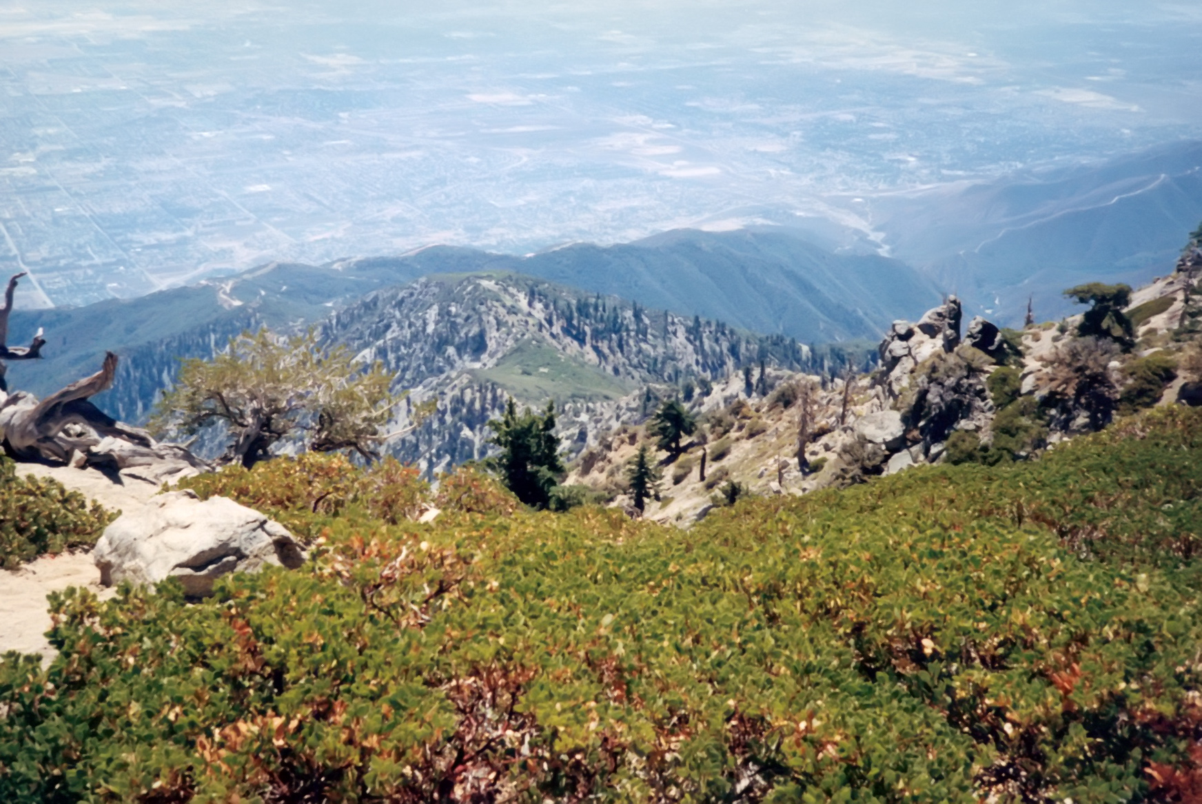
|---|
| View from Cucamonga Peak |
Access to the trailhead is along a 12 mi long, very rough mountain road known as the San Servaine Road which accesses the San Servaine Flats from the Lyttle Flats road north of San Bernadino.
Before the San Servaine Flats acquired its current name it was the hideout of the outlaw Tom McCauley better known as James or Jim Henry of the Mason Henry Gang. When the American Civil War ended in April with Lee's surrender at Appomattox the gang with a price on their heads, came under pressure from the Union Army and law enforcement officials in Central California. They moved into pro secessionist Southern California and split up. Henry with part of the gang moved into the eastern San Gabriel Mountains at San Sevaine Flats from which they began rustling, committing robbery and murder as they did. Henry was killed by a posse led by San Bernardino County Sheriff Benjamin Franklin Mathews on Sep.14, 1865, at San Jacinto Canyon in Riverside County.
Trailhead
Driving south on I-15, take the I-15 after the I-215 fork and exit at Sierra Avenue. Make a right at the stop sign at Nealey's Corner (34.18723oN -117.43887oW) and head towards Lytle Creek on Lytle Creek Road. Approximately 1.5 mi from Nealey's you will find a gated forest road on your left at 34.20165oN -117.44782oW. This is the entrance to the San Servaine Road (Forest Road IN34) which is closed from Mar.1 until Sep.1 for mule deer fawning. It can also be closed because of weather. The public is still welcome to use the road for hiking but no vehicle access is allowed. Call the Lytle Creek Ranger Station (909-382-2851) for current road and trail conditions and wilderness permit availability.
The San Servaine road requires a high-clearance vehicle. About 7.7 mi from the Lyttle Creek Road, you come to a junction at 34.19919oN -117.48046oW and 4530 ft where you turn left (right is the way to the radio tower). From there you proceed west past San Sevaine Flats (34.222778oN -117.585278oW, altitude 5545 ft). The road requires a four-wheel drive vehicle beyond this point; it passes the prominent Buck Point and contours around the headwaters of the South Fork of Lyttle Creek. Finally, after 11.6 mi from the Lyttle Creek Road, you arrive at the Big Tree Campground and the Joe Elliot Memorial Tree (large tree felled by explosives) at 34.21862oN -117.5520oW and elevation 5800 ft. Continue northwest a short distance to the Cucamonga Peak trailhead at 34.22231oN -117.55545oW and elevation 6100 ft. Park here at the Cucamonga Peak trailhead.
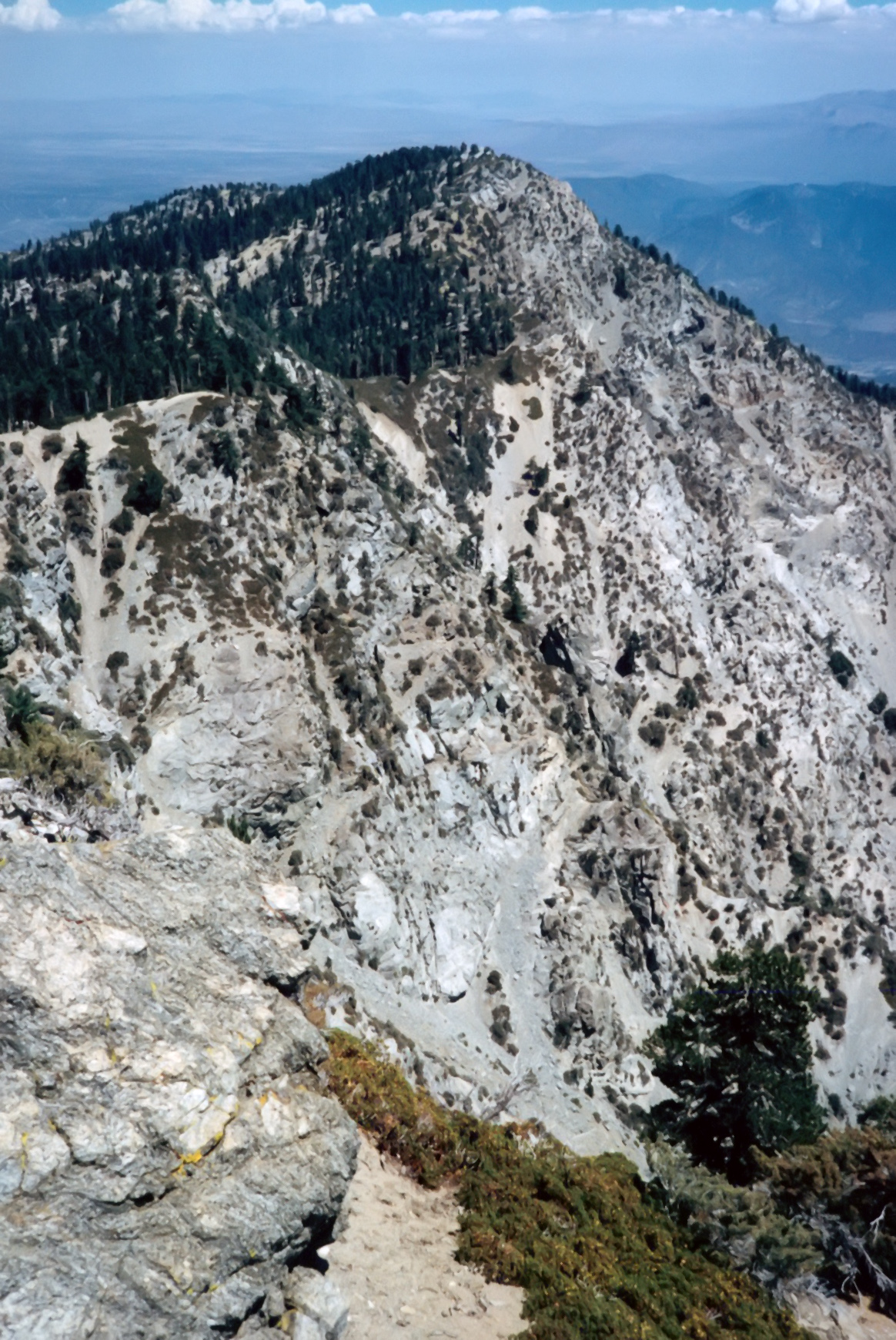
| 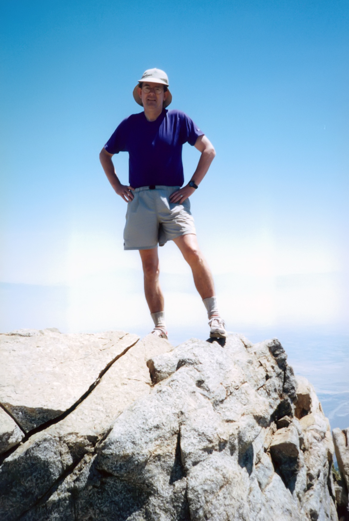
| |
|---|---|---|
| Etiwanda from Cucamonga Peak | Author on Cucamonga Peak |
Hike
The trail starts a short distance north of Joe Elliot Memorial Tree (34.22231oN -117.55545oW and elevation 6100 ft) and heads northeast. After a switchback it curves around a basin and up to a ridge at 7080 ft with two small mining cabins. The trail then climbs steeply around to the north side of a major ridge, past the 8386 ft and 8662 ft peaks and along the north side of the ridge containing Etiwanda peak (34.228397oN -117.57251oW, elevation 8662 ft). You follow the trail to an elevation 8420 ft due west of Etiwanda and about 4 mi from the start where you will encounter a cairn marking a short spur trail up to the summit of Etiwanda (an optional sidetrip). You should reach that spur trail about 3 hrs from the start. From there it takes about 1.0 hr of easy hiking to reach the 8862 ft summit of Cucamonga Peak (34.22278oN -117.58505oW) about 6 mi from the start. Shortly before you get there, the trail splits and you should take the left fork to the summit. The view is among the best in the San Gabriels.
Last updated 7/30/99.
Christopher E. Brennen