OF LOVE AND EXPLORATION - AN AUTOBIOGRAPHY
© Christopher Earls Brennen
ZION NARROWS
The Indians call the canyon through which it runs, Mukun'tuweap,
or Straight, Canyon. Entering this, we have to wade up the stream;
often the water fills the entire channel, and although we travel
many miles, we find no floodplain, talus, or broken piles of rock
at the foot of the cliff. The walls have smooth, plain faces, and
are everywhere very regular and very vertical for a thousand feet
or more ...''
From ``Canyons of the Colorado'' by John Wesley Powell.
The North Fork of the Virgin River begins high on the 7000-8000ft Markagunt Plateau in southwestern Utah, about a hundred miles north of the Grand Canyon. In these early reaches there is little that distinguishes it from hundreds of other streams that gather water from the summer thunderstorms and the winter snow melt and help irrigate the rolling hills, meadows and forests of the sparsely populated, open sky country of that high plateau. The spectacular nature of the North Fork only becomes apparent if you follow it to the edge of the plateau, where it has carved a chasm 2000ft deep into the Markagunt and created the truly spectacular canyons of Zion National Park. For about 16 meandering miles that chasm is an incredibly narrow ``slot'' canyon, in places only 20 to 30ft wide with vertical walls rising out of sight on both sides. Later it broadens to form the wider, yet still awesomely vertical canyon visited by those who drive up from the south entrance to see Zion National Park by automobile. But to really experience the magnificience of the North Fork of the Virgin, you must venture into the narrow, storm-sculpted sandstone gorge they call the Zion Narrows. With its raging rapids, its soaring, fluted walls and hanging grottoes it is a rare and awesome place.
The best way to make this pilgrimage is to begin high up on the Markagunt Plateau, north and east of the Park, and to follow the river all the way down through the Narrows to the point where it emerges into the broader canyon of Zion National Park. Though it is marginally possible to accomplish this in one very long day hike, it is clearly preferable to overnight in the canyon. This requires a permit from the Park Service and the allocation of one of the ten small campsites that are located along a central stretch of the canyon where there are occasional spots of accessible high ground.
There is, of course, danger involved in that adventure for the storms that sculpted the Zion Narrows still occur and the slot canyons still focus the runoff and create raging flash floods that crash through the canyon sweeping all before them. The bare rock of much of the surrounding land does not absorb much water and the steepness of the terrain accelerates the runoff. And, worse still, there are miles of canyon in which there is little or no accessible high ground where hikers can seek refuge from these floods. The Park service posts stern warnings about this danger and issues flash flood alerts but these efforts cannot eliminate the risk. During a flash flood the water level rises almost instantaneously - within minutes or even seconds. The hiker must not only find high ground in any local rainstorm but must also be aware of the flood potential of quite distance storms. Thus he or she must be alert to the other signs of a possible flash flood such as rapid increase in the muddiness of the water or the roar from the upstream flow. Because of the danger in the Zion Narrows, the Park Service does not issue permits to hikers until the day before the intended hike and suspends the process when thunderstorms are imminent.
A second, less obvious danger in this adventure is the possibility of hypothermia. For more than half of the length of the hike, there is no alternative but to hike in the river itself. While this is usually no more than about a foot deep, there are places where it is necessary to wade through chest deep pools and once or twice you must swim. This means that the hiker is wet for a substantial fraction of the time (``wicking'' clothing of polyester or similar material is essential) and, since the sun does not penetrate the depths of the Narrows very often, prolonged coldness can lead to serious hypothermia even in mid-summer. At other times of the year, a wetsuit is essential.
One July day in 1998, I set off to hike the Zion Narrows with Troy Sette, Clancy Rowley and John Lim. Troy and Clancy were veterans of adventure hikes in southern California and the Sierra Nevada; John was a relative novice. I left home the week before to do some hiking elsewhere in Nevada and Utah. On Monday, July 27, I was high up on the summit of 11,918ft Charleston Peak in southwestern Nevada when I witnessed a very violent thunderstorm on the eastern horizon. The lightning of this storm flashed across the distant sky with an intensity that frightened me off the summit. But I thought little more about this common summer occurrence in the southwest until I arrived in Zion National Park some three days later, on the afternoon of Thursday, July 30. As the advance party, I had volunteered to reach Zion early in order to secure the permit from the Visitor Center in Zion National Park and to set up camp. I planned to obtain the permit for our Saturday departure, first thing on Friday morning. However, when I arrived at the Visitor Center on Thursday evening, it was disconcerting to find the following cutting from the Salt Lake Tribune prominently displayed on the notice board:
The Salt Lake Tribune, Wednesday, July 29, 1998:
Hikers Find Body Floating In Virgin River
Hikers in Zion National Park discovered the body of an apparent drowning victim floating along the north fork of the Virgin River on Monday night. Officials believe the man had been hiking in the southwest Utah park along the Narrows, a canyon through which the north fork of the river runs, when he was swept away by swift currents caused by a flash flood Monday afternoon. About 14 hikers, stranded by the flood, saw the body floating down the river and recovered it Monday evening. Early Tuesday morning, the group was able to hike out of the area and told a park ranger about the body, said Denny Davies, a park spokesman. The National Park Service Search and Rescue squad carried the body out Tuesday, but investigators were unable to immediately identify the man. ``There was no identification on the man, and we haven't heard any reports about a missing person,'' Davies said. Washington County Sheriff Glenwood Humphries said the body had been badly beaten by rocks in the river. The man is described as a male in his 40s between 230 and 250 pounds.
Davies said the north fork of the Virgin River rose about three feet due to the torrential rains that hit the area Monday afternoon. He estimated the river flows increased from 110 cubic feet per second to 740 cubic feet per second by 7:30p.m. The Narrows was named because the canyon narrows to between 20 and 25 feet in some areas. Park rangers have warned it is dangerous to hike in the area when flood potential is high in July and August. ``Because the canyon is so narrow, there are not a whole lot of escape routes when there is a flash flood,'' Davies said. National Weather Servive meteorologist Bill Alder said Zion National Park headquarters received .47 inches of rain late Monday afternoon, while Lava Point area, just west of the Narrows, received about .37 inches.
The Salt Lake Tribune, Thursday, July 30, 1998:
Second Body Pulled From Virgin River
Searchers pulled the body of a second California man from the north fork of the Virgin River in Zion National Park Wednesday where a flash flood apparently swept both men to their deaths. The body of Ramsey E. Algan, 27, Long Beach, Calif., was located Monday evening by several stranded hikers. The group was able to hike out the next day and alert park rangers. Wednesday morning, about 1 1/2 miles upstream, the body of Algan's hiking partner, Paul Garcia, 31, Paramount, Calif., was found by search and rescue workers. Both men had apparently been hiking along the Narrows, a slot canyon in which the north fork of the river runs, when they were swept away by swift currents caused by a flash flood Monday afternoon. Officials had no idea that Algan had a hiking companion until late Tuesday night when officials found the victim's car, said Denny Davies, park spokesman. ``Rangers found an unlocked car with two wallets inside, which contained both men's identification,'' he said. Later, other hikers who had been in the Narrows and survived identified Algan from his license photo. The same hikers also said another man who fit the description of Garcia was with Algan before the rainstorm hit. A search was initiated Wednesday at 11:20 a.m. The body was caught in the river's debris, Davies said. He said the north fork of the Virgin River rose about 3 feet due to torrential rains Monday afternoon. He estimated the river flows increased from 110 cubic feet per second (CPS) to 740 CPS later that night. National Weather Servive meteorologist Bill Alder said Zion National Park headquarters received .47 inches of rain late Monday afternoon, while Lava Point area, just west of the Narrows, received about .37 inches.
The Zion Narrows route is a rugged 16-mile hike in a narrow canyon 800 to 1,000 feet deep. About half the hike is through the river itself. Park Managers have cautioned people that they should avoid hiking when flood potential is high, especially during July and August. Hikers are also strongly urged to get updated weather information in any narrow or slot canyon, particularly when afternoon thunderstorms threaten. ``We cannot stress too strongly that visitors need to heed these flash flood warnings and plan alternate trips that don't include slot canyons,'' said acting superintendent Eddie Lopez. These are the first fatalities in Zion National Park this year. Alder said since 1950, there have been 22 flash flood fatalities in Utah.
I suspect that these press clippings and the whispered conversations they produced resulted in the very short queue for permits when the Visitor Center opened at 8.00am the following morning. I was second in line behind two men and a woman who had hiked the Narrows the previous year and were returning to do so again. That was reasssuring. Behind me came several men bound for the other popular wilderness hike known as ``the Subway'', followed by an easterner called Neal Litman who intended to hike the Narrows with his wife and two children. That sounded a dubious proposition to me and subsequent events were to confirm this instinct. But at the time I was too intent on our own plans to dwell on the intentions of others. When my turn came, I was duly warned of all the dangers, told where I could park and where I could not and was issued a permit for the Zion Narrows hike. In the process, I was allocated one of the twelve numbered campsites in the Narrows and chose Number 7, Boulder Camp. Late that evening, Troy, Clancy and John arrived and we were ready for our Zion adventure.
We arose at dawn the next morning and sorted out our equipment, trying in the process to minimize our backpacks while ensuring that we were equipped for all eventualities. Since the weather forecast indicated little chance of rain (and therefore the posted flash flood warning was low) we decided not to carry a tent but to rely on a large groundsheet for emergency cover. Preparations complete we set off up the road into Zion Canyon. That road ends at a spectacular amphitheater known as the Temple of Sinawava, a busy and popular place for visitors to the National Park. Many of these tourists park and then walk along the asphalt trail called the Riverside Walk that penetrates another mile into the Virgin River Narrows. The trail ends where the river fills the canyon, but many of the more adventurous wade further upstream, some for several miles to the truly awesome section of the Narrows.
But we had a more ambitious objective and therefore, after parking and securing my Mitsubishi Montero near the Temple of Sinawava, we loaded all our packs into Troy's Nissan Pathfinder and headed back down the Zion Canyon Road. At a road junction in the Park we turned left and headed eastwards bound for the trailhead in Chamberlain's Ranch on the Markagunt Plateau to the north and east of the Zion National Park. This 1.5hr drive begins as the spectacular Zion-Mt.Carmel Highway climbs the east wall of the Zion Canyon before exiting the Park. About 2.5m beyond the East Entrance to the Park, we turned north on a paved road that changes to dirt after several miles. The road winds its way across the plateau and then descends to cross the Orderville River, climbing again and cresting a ridge before descending to a bridge that crosses the North Fork of the Virgin River. The distance from the main highway to this bridge is about 18m. The dirt road turns right after the bridge, but we turned left and, after 0.25m arrived at the gate to Chamberlain's Ranch. The owners are kind enough to let hikers pass through as long as they are careful to close the gate behind them. After this, it is another 0.5m to a rough parking area at the trailhead situated just before the road fords the river.
 | 
| |
|---|---|---|
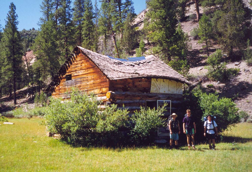
| Bullock's Cabin | Upper Canyon |
It was a beautiful, crystal clear day on the high plateau and our spirits soared with the expectations of a new adventure. The remote ranchland on which we found ourselves was delightfully bucolic, a gentle river valley with a stream and rolling pastures surrounded by low, tree-covered ridges. Soon we were ready and strolled easily along the rough dirt road as it paralleled the North Fork on the route westwards. About 50min from the start we passed an old wooden structure, Bullock's Cabin that may have once served as home to some proud pioneer but had long since been converted to a shelter for the ranch cattle. Soon the pastureland and the road ended and the valley sides began to close in as the Virgin River cut more deeply into the Markagunt Plateau. This stretch provided a beautiful and serene hike on a lovely summer day. A well-worn use trail made progress easy though the river crossings increased in frequency and difficulty.
Two and a half hours from the trailhead we heard voices ahead of us and soon came upon Neal and Kathy Litman and their children, Jackie (aged 11) and Ben (aged 8). They were enjoying a rest beside the stream. Having taken the 6.30am shuttle bus from Zion Lodge to the trailhead, they had started hiking about an hour before us. They seemed to be enjoying the surroundings as much as we were though Neal's apparent difficulty with his water filter was a worrying omen. Experience had taught us the critical importance of water filters in the deserts of the southwest and so we carried at least two. We learnt that the Litmans were from the east coast and that they had been planning this trip west for a long time. I wasn't at all sure that they realized the magnitude and lack of forgiveness of the western wildernesses. And I suspected that it would not be the last we saw of them; I learnt that they were bound for Camp 9 and made a mental note to make sure they passed our Camp 7 later that day.
 | 
| |
|---|---|---|
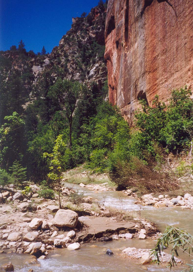
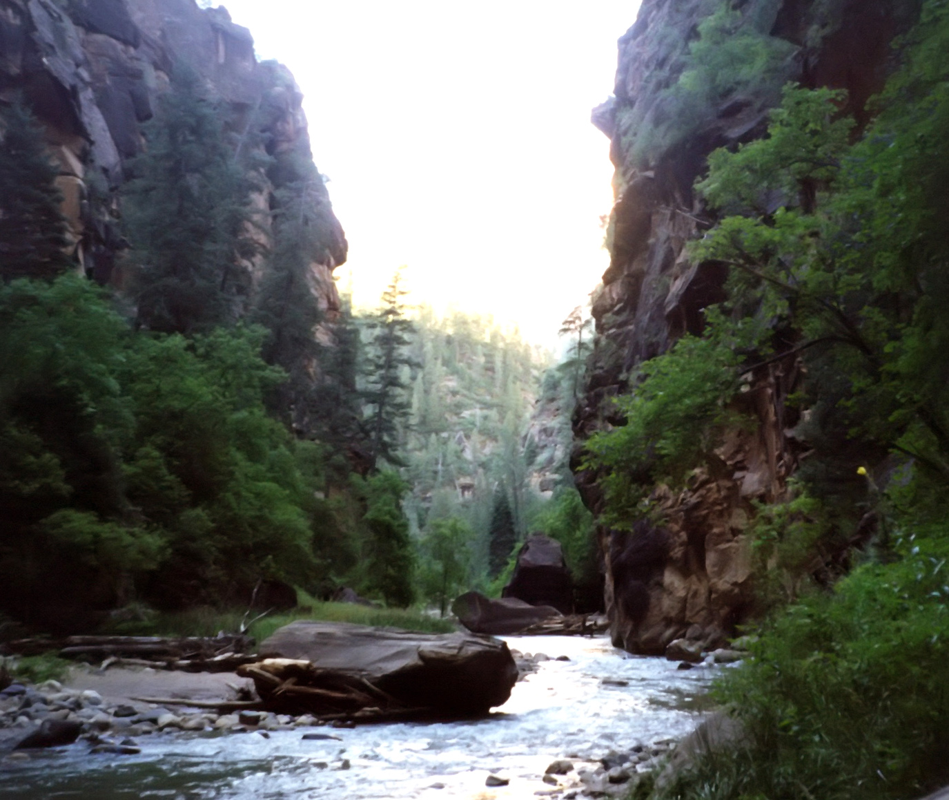
| Entering First Narrows | First Narrows |
Soon the walls became vertical and the valley was transformed into a classical ``slot'' canyon with fantastic sculptured walls and cool grottoes. Three hours from the trailhead, we found a very pleasant, sunny bench for our lunch stop and, in no hurry, took some additional lazy time to enjoy the marvellous surroundings. As we did Neal and Kathy and the kids repassed us moving at a good pace. Clearly they were practiced hikers even though they were now in a new and different land. And so, when we resumed our hike at a leisurely speed they kept pace with us. Shortly thereafter (3.5hrs from the trailhead) the width between the walls closed in so that, in places, they were as close as 20ft. We had arrived at the first narrows. Experience in other canyoneering adventures had taught us that such narrowing was almost always accompanied by waterfalls and places where progress downstream required climbing. But, with a few modest exceptions, this was not the case in this Zion canyon. For much of the way, the river occupied most of the width of the canyon bottom and the sediment carried by its frequent flash floods is apparently sufficient to even out the longitudinal grade to one that only produced small cascades. And even these seemed temporary having been formed by logjams.
About 5hr from the start we came across just such a logjam that was easily climbed. It was somewhat disconcerting that Neal and Kathy were initially somewhat intimidated by this obstacle that seemed a minor one to us. Perhaps it was the pool downstream of the jam that alarmed them since, given the murkiness of the water, it was not possible to tell how deep the pool was ahead of time. They seemed reassured when we helped escort the kids through this obstacle.
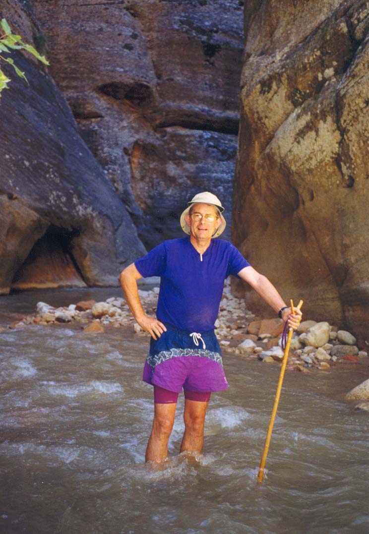
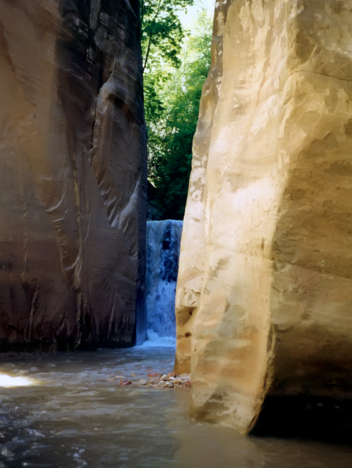
Just a short distance downstream we came upon the only substantial waterfall on this hike, a vertical drop of about 15ft in a very narrow section. Fortunately, a crack in the rock off to the left provided an easy passage around this otherwise difficult hurdle. By now it was becoming apparent that the experience Troy and I had acquired navigating routes down wilderness canyons was going to be valuable to the whole group and that without such experience, the hike would be much more difficult and time-consuming. And so we naturally fell into a mode in which Troy and I would take turns leading the group and exploring ahead for the best route through the boulder-strewn cascades and the deep pools.
 | 
| |
|---|---|---|
| Waterfall | Near Deep Creek junction |
It was about this time in mid-afternoon, that I began to notice John falling behind us despite the slow pace set by the Litman family. Soon it was evident that John's lack of hiking experience was going to be a problem. Despite his youth and his soccer-playing fitness, his legs, unused to travel over such rough terrain, were giving him considerable difficulty. Indeed, his pace slowed so dramatically that the Litman family began to pull ahead of us and we had to relieve John of his backpack. Troy and Clancy carried most of the added burden. We fashioned two walking sticks for John and treated his pain with Motrin. In this adjusted mode we soon caught up with the Litman family again. I had no doubt that Troy, Clancy and I would make it through the Zion Narrows; however, I was beginning to wonder if we could carry all the others with us.
Shortly after the waterfall, we came upon the woman and two men who had been in front of me in the Visitor Center queue and who had travelled on the 6.30am shuttle with the Litmans. Having come this way before, they seemed relaxed and comfortable. Together we arrived at the readily recognized junction where Deep Creek joins the North Fork from the right. Here we paused at the relatively broad beach in the middle of this cathedral-like junction, towering vertical walls on all sides. Just upstream of this point we had swum through a deep pool and so we needed a moment to warm up especially since the light and the warmth in this deep recess had already begun to wane at the end of the day. It was now 6.5hr since we had set out from the trailhead.
Deep Creek has a significantly larger volume flow rate than the North Fork and so the river downstream of the junction is notably deeper and harder to hike through. By now both John and the Litman kids were beginning to show signs of serious distress. However, the goal for the day was within striking distance. The numbered campsites begin at the Deep Creek junction. Number 1 lay in a slight rise just to the south and we could count our way down as we approached our assigned spot. About 40min later we passed the junction where Kolob Creek enters from the right and just a few minutes later arrived at our campsite, Number 7 or ``Boulder Camp.'' Unlike some of the earlier camps that did not seem high enough above the river for comfort, Boulder Camp was up a wooded slope, a reassuring 20ft or more above the river. A very comfortable site, it also included a large overhanging rock that would provide ample shelter in case of rain. A deer was sitting only yards from our site and seemed quite undisturbed by our presence. And, in addition to the small flat area intended as Number 7, there was another cleared area just a few yards away. When the Litmans struggled by a few minutes later, I suggested that they should stop at this ancillary campsite instead of continuing on to Number 9. They jumped at the chance to spent the night close to us.
And so we all prepared for the night at Boulder Camp. We spread our lightweight tarp out under the overhang and were therefore well prepared for any change in the weather though none seemed likely. Our sleeping bags would keep us plenty warm. On the other hand the Litmans had choosen to bring a tent but no sleeping bags, fearing rain more than cold. I think they spent a miserable night huddled together in their tent. We were able to help them with our water filter and gave the kids some snacks. Indeed the kids seemed to gravitate toward our camp, drawn perhaps by the sense of security generated by our confident demeanor. Except, of course, for John though he was recovering a little with rest and food. We ate much spaghetti followed by fruit, other snacks and, needless to say, hot chocolate. Thus warmed, we slept well in that deep recess in the earth.
Shortly after sunrise the next morning, we had eaten breakfast and packed up ready to resume our adventure. The family had little left to eat and so I gave each of the kids a poptart and cheered them along. We left camp as a group about 7.00am.
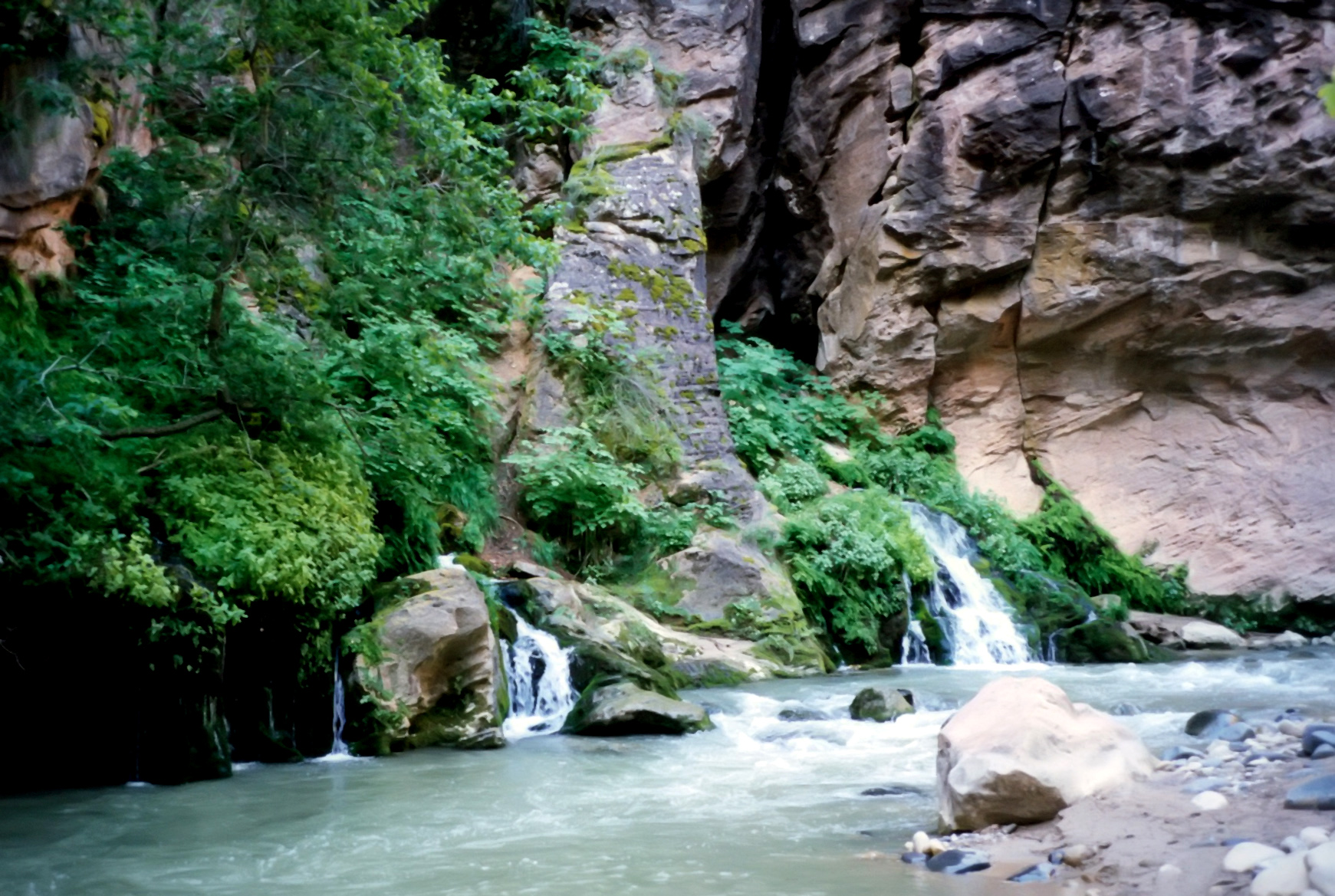
Downstream of Boulder Camp the canyon becomes quite rugged. Regular stretches of white water required a practiced eye for navigation so Troy and I took turns leading the pack. We passed each of the other numbered camps, encountering in Number 10 (``Alcove'') yet another struggling hiker, a young man with a badly sprained ankle. But we had more than enough on our hands and he had a number of companions to help him. And so we did not volunteer any help. Finally we passed Number 12 (``High Camp'') and, 300yds later arrived at Big Springs, a notable feature in which a very substantial stream issues from springs in the right canyon wall. Ferns and other greenery adorn these springs and make it a pleasant place to stop. We reached Big Springs about 1hr 30min after our morning start.
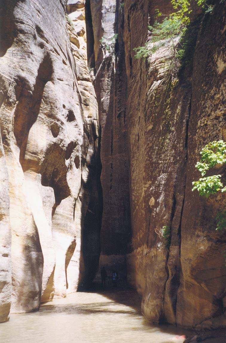
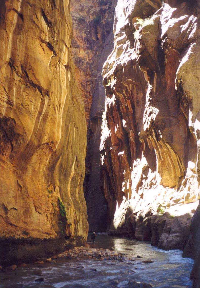
Up to this point, though the towering walls soared over 2000ft above us on all sides, there were still occasional places where the canyon widened and small, sloping benches of trees and ferns were scattered along the sides of the river. Often these provided the easiest route of passage downstream. More importantly, they would serve as refuge in the event of thunderstorms or flash floods. Indeed, like all the other overnight sites, Boulder Camp had been situated on such a sloping, wooded bench. However, downstream of Big Springs, the canyon walls close in even further and the river and its gravel beds fill the entire width of the base of the slot. For more than three miles there are no benches on either side. No greenery, no refuge, and no sunlight except for a few minutes around noon. Just awesome vertical walls, running water and the gravel it carries with it. Even in mid-summer when the desert high above boils in the midday sun, down here in the depths of the Zion Narrows it is cold and wet and you must keep moving to prevent hypothermia.
We left Big Springs as a group a little before 9.00am and began our passage through this most dramatic section of the Zion Narrows. Because the risk of unexpected thunderstorms and flash floods is least during the morning hours we felt comfortable with our timing, especially since we could make out a strip of clear blue sky high above us. Both John and the children were already beginning to show signs of weakness and cold and so we kept moving at a brisk pace. Inevitably though, Troy or I would find ourselves far ahead of the pack and have to pause to allow them to catch us. Clancy, Troy and, to a lesser degree, myself were still carrying all of John's pack as well as helping the children with the deep wades and few swims. But, above all, it was a truly awesome place and the memory of that majesty will always be with me.
 | 
| |
|---|---|---|
| Big Springs | Zion Narrows |
It took a little over 2hrs to travel through the heart of the Zion Narrows. In all that time, we had no direct sunlight. But, just upstream of the junction with Orderville Canyon, the Narrows widen a fraction and, on the inside of a lefthand turn, we came to a marvellous sunlight beach where we stopped to warm ourselves, to rest and to snack. John was really struggling on his two walking sticks and limped onto this beach about 10min behind the rest. The children already seemed rejuvenated by the sun. And, a few minutes later, we encountered the first hikers coming upstream from the Temple of Sinawava; they had set out early that morning to explore the Narrows from below. That was heartening for it meant that we had only a little over 2hrs of hiking ahead of us. More disconcertingly, a young man and woman came downstream and voiced concern about people they had encountered the previous day. Those people had started late because they rode from Zion Lodge to Chamberlain's Ranch on the 9.30am bus. Two of these people, it was reported, had baulked at the log jam like the Litmans. Moreover, they had not shown up at their campsite in the evening. The young couple wanted us to report this to the rangers. Consulting privately later, Troy and I decided that there was insufficient cause for alarm. Surely, changes of plans like this must happen every day; most of the hikers we encountered had seemed unprepared for the ruggedness of this western wilderness. And it was perfectly possible to hike back to Chamberlain's Ranch from the location of the logjam.
About 11.20am we left our sunny beach and plunged again into the shade of the Narrows. Almost immediately we encountered the junction with Orderville Canyon, a narrow slot entering on the right. The previous day we had crossed the upper reaches of Orderville on our drive to Chamberlain's Ranch and the descent of Orderville Canyon is another adventure to which we will return someday. And so I was not inclined to explore upstream into Orderville but pressed on downstream. Shortly therafter, Troy, Clancy and I conferred. Since, more and more people were appearing from downstream and help would be available if needed, we decided that Troy and I would press on ahead leaving Clancy to acompany John and the Litmans at their pace. This would allow Troy and I to drive back to Chamberlain's Ranch to collect Troy's vehicle.
A short distance downstream of Orderville junction, the canyon broadens a little and the wooded benches appear again. Sunlight penetrates and it is a beautiful hike downstream to the the point where the concrete Riverside Walk ends. Now there were crowds of people enjoying the canyon and the adventure of a short hike up into this wilderness. The sun and the beauty stirred my soul and my bones and the pack seemed to lighten on my back as I walked that last mile behind Troy. When we reached the Riverside Walk at 12.20pm we shook hands, communicating our shared pleasure in another marvellous adventure.
We drove uneventfully to Chamberlain's Ranch and there parted company.
I was bound for the east to hike in Bryce Canyon. Troy drove back
into Zion to collect Clancy and John at the Temple of Sinawava. I was
only later to confirm that all ended well for both John and the Litmans.
But I often wonder if either realized how narrow their margin of
safety had been during those days in the Zion Narrows.......
Last updated 7/30/99.
Christopher E. Brennen